
St Bees – Ennerdale Bridge: 14 miles
Ennerdale Bridge – Borrowdale: 14.5 miles
Borrowdale – Grasmere: 7 miles
Grasmere – Patterdale: 7 miles
Patterdale – Shap: 15 miles
Shap – Kirkby Stephen: 21 miles
South-East London to St Bees.

If it possible to experience a culture shock within the shores of Great Britain then the difference between south-east London and the north-west of England would probably define it. After arriving in Carlisle from Euston, I took a connecting train to St Bees, a journey which skims the edges of Cumbria, in parts running directly adjacent to the coastline with views over the Irish Sea and the distant hills of Scotland. Although it felt eerily bleak and empty, the blend of greys from sky to sand gives it a beautiful monochromatic calmness. At St Bees seafront the silver lozenge of the bay sweeps up to the rows of soulless mobile homes on its shores. Despite it being a Saturday afternoon in August’s peak summer season, the area was strangely devoid of people. I had my dinner at the The Seacote Hotel which was reminiscent of a 1980s social club minus the cigarette smoke, but they did serve me a delicious meal of pan-fried Salmon and rice, served with a plate of chips for three (apparently normal practice up here – answers a few questions). I pitched my tent at the caravan park with an overwhelming desire to leave as soon as it was possible.
Day 1: St Bees to Ennerdale Bridge – 14 miles
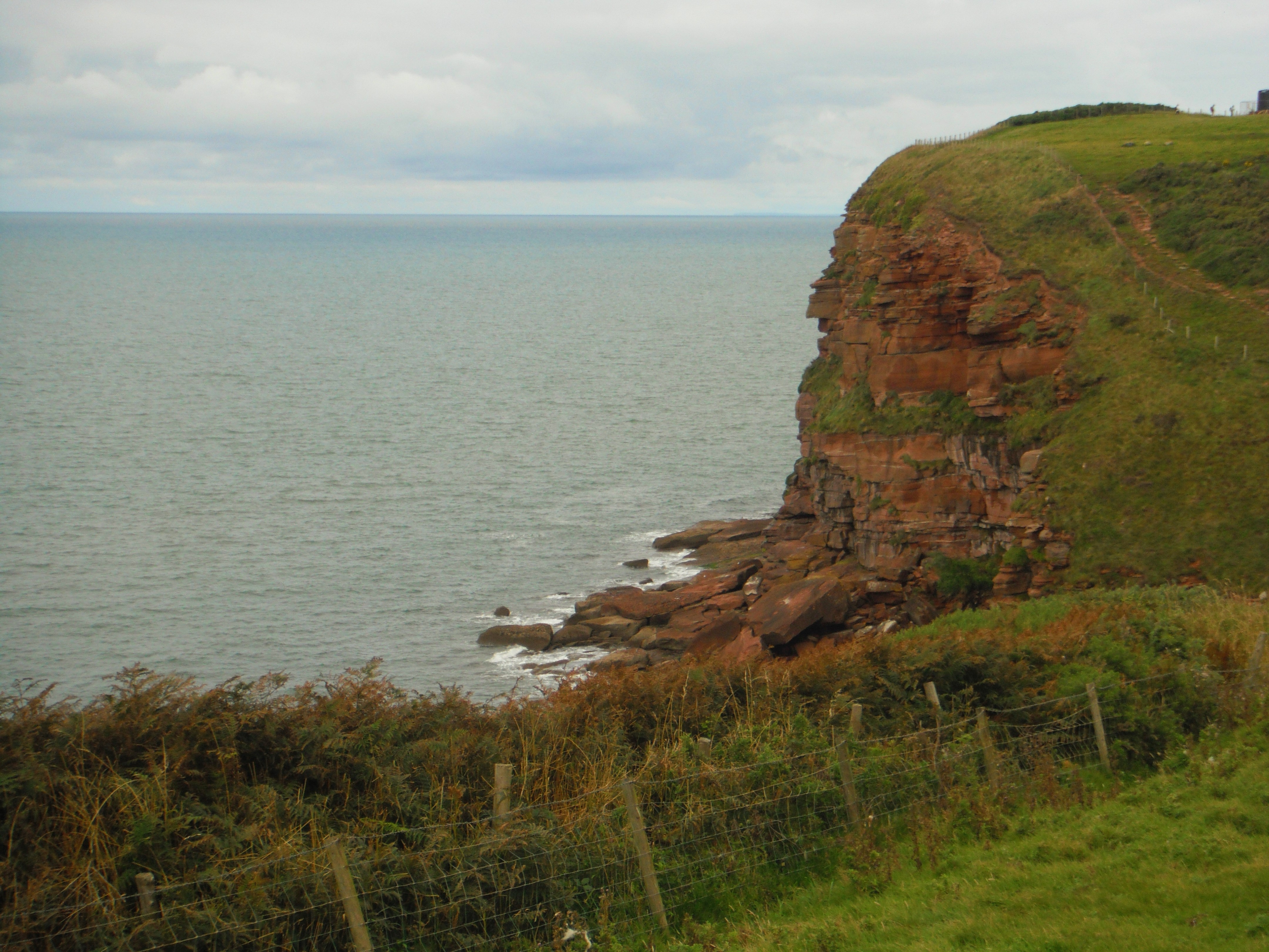
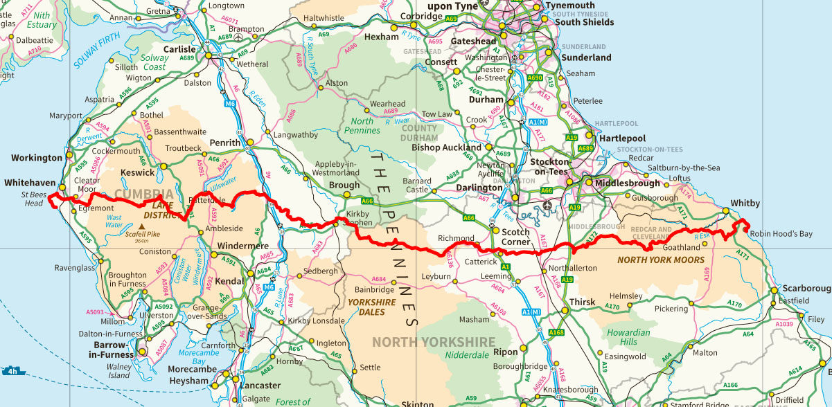
Needless to say, it felt good to pack up my tent and leave behind Seacote’s characterless world of caravans. My first stop was the Coast to Coast monument and accolade to Wainwright who devised the path in 1973, before heading up the path to begin the coastal trail. I envisioned this first section of the walk being quite monotonous, just a preamble to the scenic gold of the Lakes, but I was wrong and should have had more faith in Wainwright. The red sandstone cliffs and the acidic green of the clifftops sparred against each other in a fabulous contrast of colours; on the distant horizon, the hills of Galloway were an iridescent slither of blue, pulling apart the grey sea and sky. Letting the wild, salty breeze blow into me and London flow out of me felt like a physical purge of all tension. I sat on a rock, drank some coffee from my thermos and watched two sleek, black crows sail over the cliff in perfect synchronicity.
This first day of the trail is fairly flat but for Dent Hill which provides panoramic views of the low lying land – a mosaic of green fields, golden crops, ploughed fields, slate rooftops and the misty sea beyond – not forgetting the nuclear outpost of Sellafield. Perhaps the defining feature of day one is the beautiful colours knitted into the landscape: Clumps of lilac Heather, long ochre grasses and the sumptuous deep green of young Spruce lace the path as it descents into a magical forest of tall thin pines. It was an enchanting part of the trail.
Although this hadn’t been a particularly challenging day, I was still elated to reach my destination of The Fox and Hounds at Ennerdale Bridge. I camped on the patch of ground outside the pub but in retrospect wished I had gone a little wilder for my wild camp. On the plus side, there was wine. Jackie and Rob from Seattle who I had met earlier in the day turned up and asked me to join them for dinner. We discussed rattlesnakes and bears compared to slow-worms and squirrels and quickly established a few reasons why you might like to come hiking in the UK.
Day 2: Ennerdale Bridge to Borrowdale – 14½ Miles
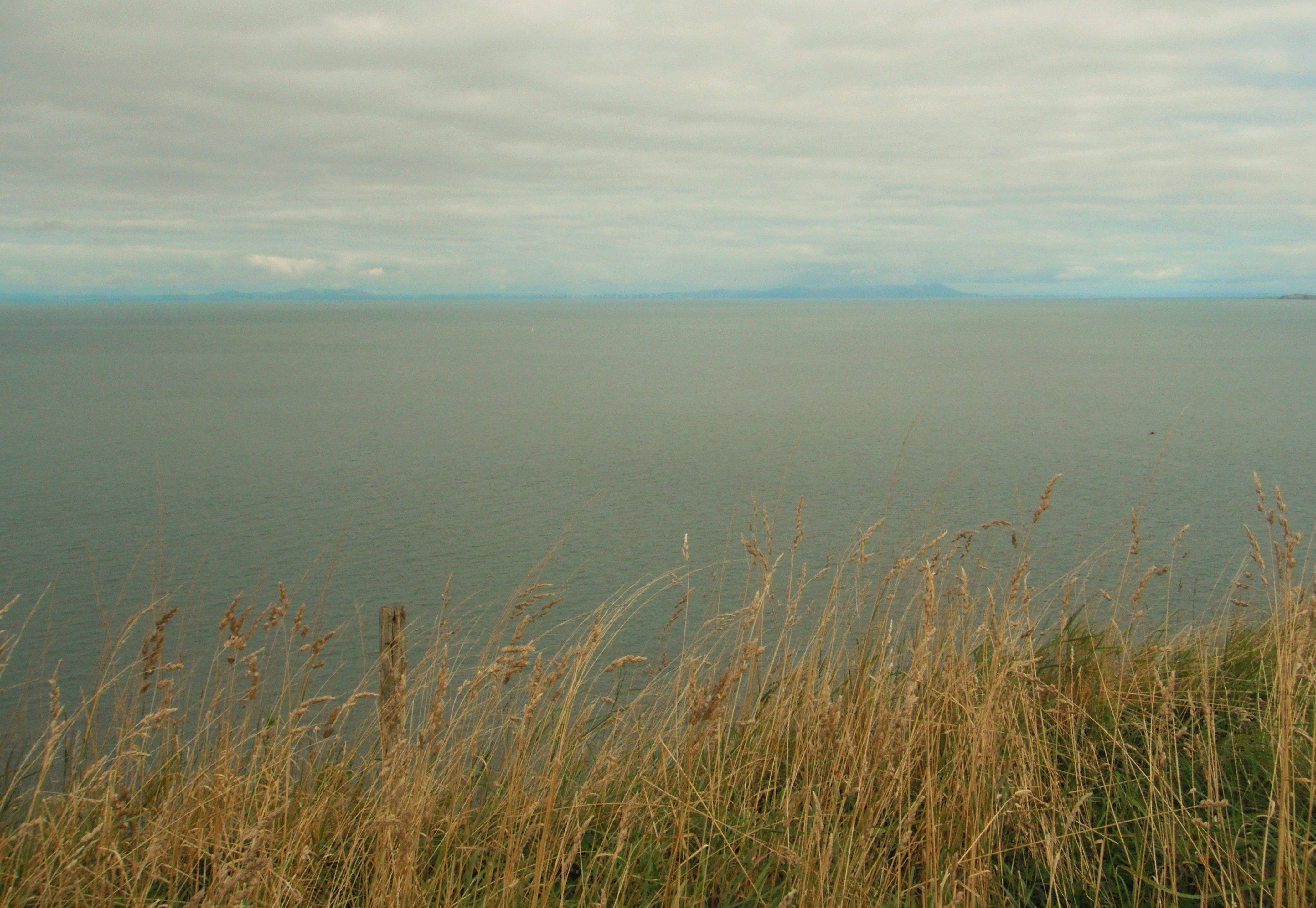
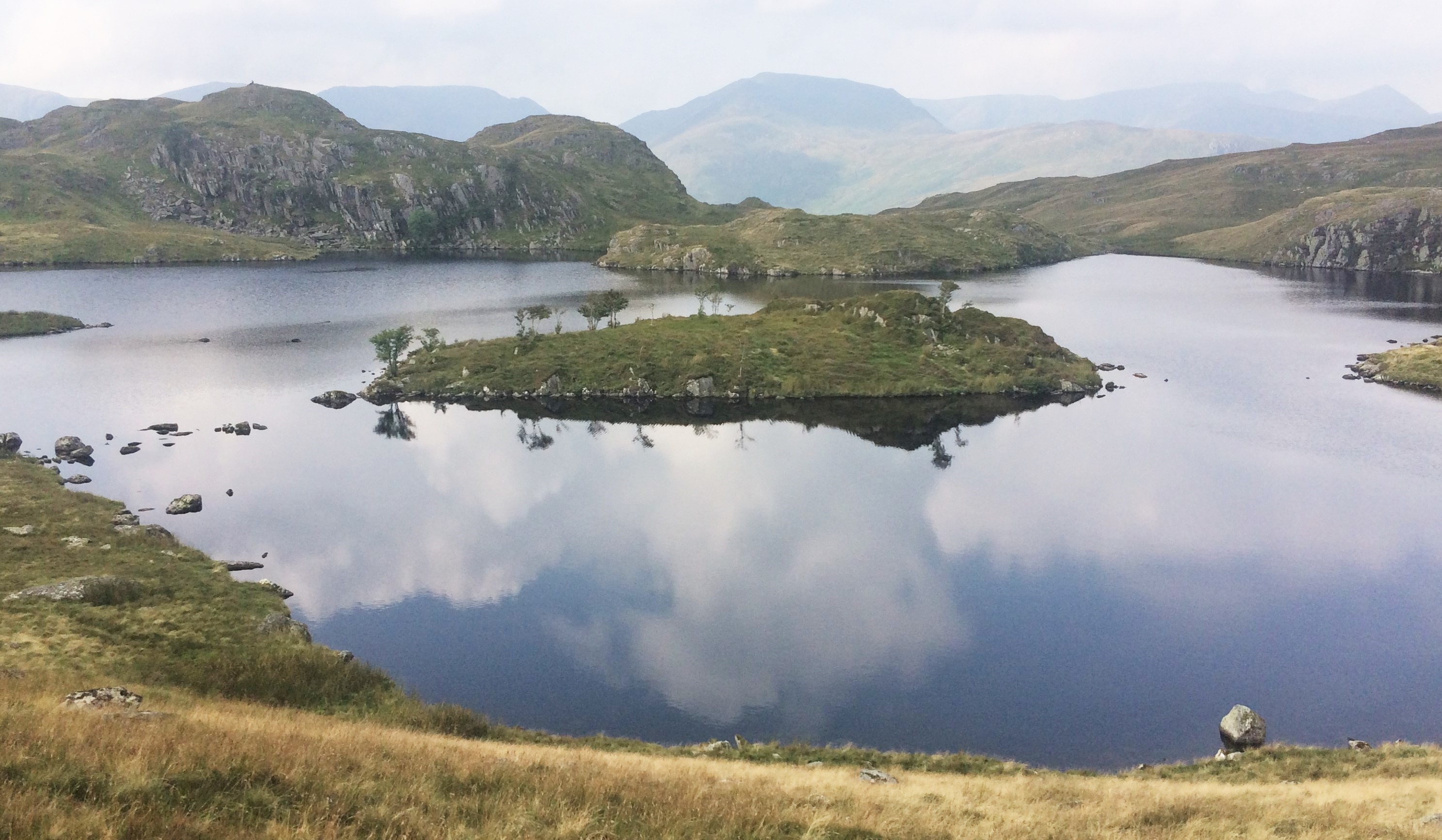
Ennerdale Water looked pretty fabulous on this fine morning. The heather throughout the hike was abundant and along this stretch the purple flowers fill the banks. So much so, I managed to forgive the woman at the Fox and Hounds who sold me a stone cold coffee for my thermos (I’m sure she had a sly smile on her face when she handed it to me). Once the path leaves the banks of Ennerdale water, it is a long hike to Blacksail Youth Hostel, apparently the most remote hostel in the UK. This is a lovely place. I could imagine cold evenings after a long walk with the wood-burner at full pelt, a bottle of red wine, some hearty casserole and good company.
My new friends Jackie and Rob were there so I stopped for tea. I also met Roy from the Wirral who was suffering with severe blisters and an over-heavy pack, and a very loud, garrulous man from Australia who was walking at a snail’s pace with two women, one who was a very unhappy looking German and the other who was blind in one eye (Roy and I both pondered on this dynamic).
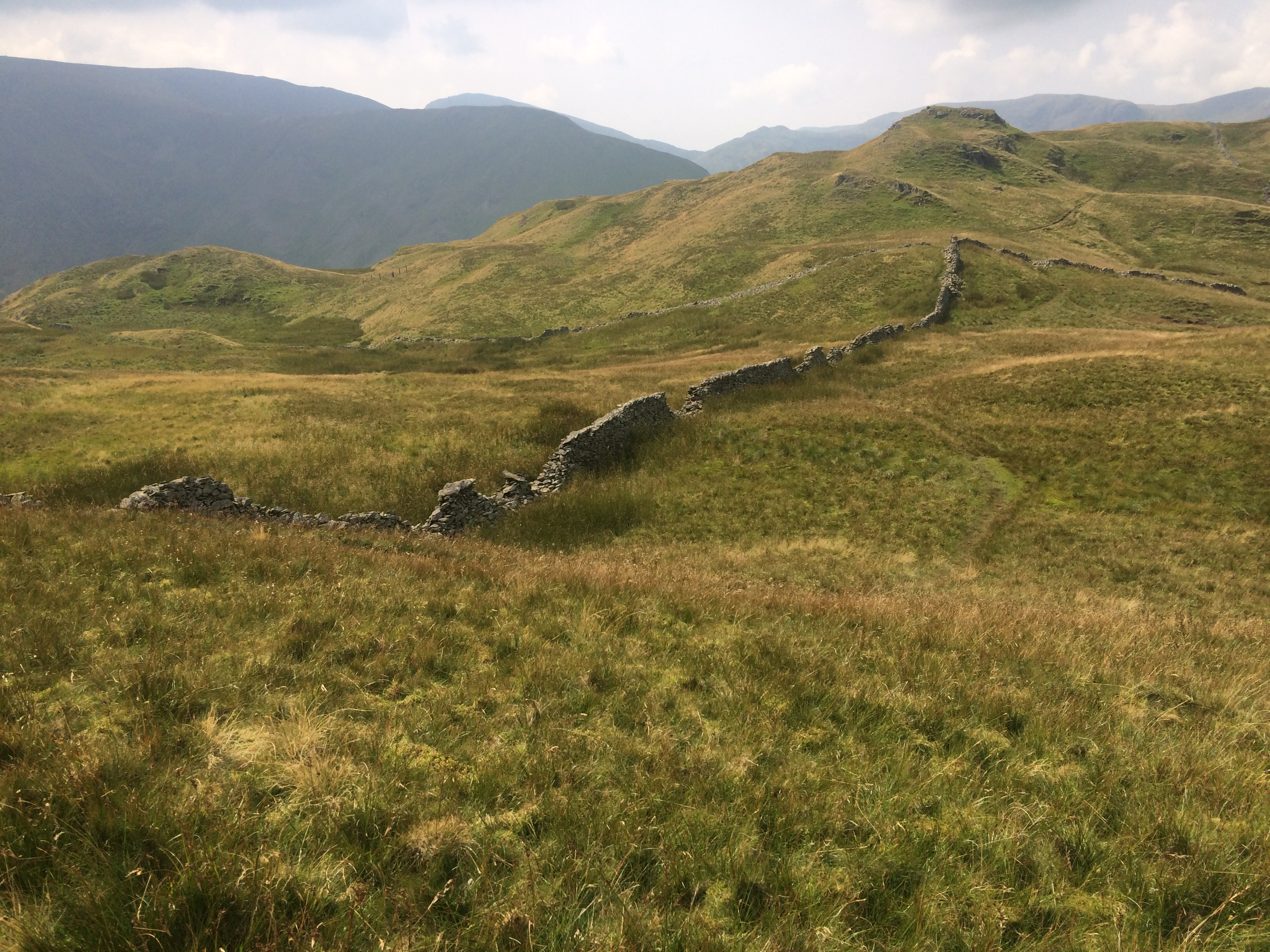
The path from Blacksail to Borrowdale takes you up through a steep valley crisscrossing a mountain stream. At this point you can do a 360° turn and see nothing but the mountains, greenery, the dusty pink of the Heather, clusters of rock and the remains of old dry stone walls; you are complexly immersed in the wildness of the Lake District, silent except the sound of stream trickling over the rocks.
I camped at Borrowdale YHA where you can have dinner and a beer in their lounge – it’s pretty good in that YHA kind of way.
Day 3: Borrowdale to Grasmere – there is no way this is only 7 miles…
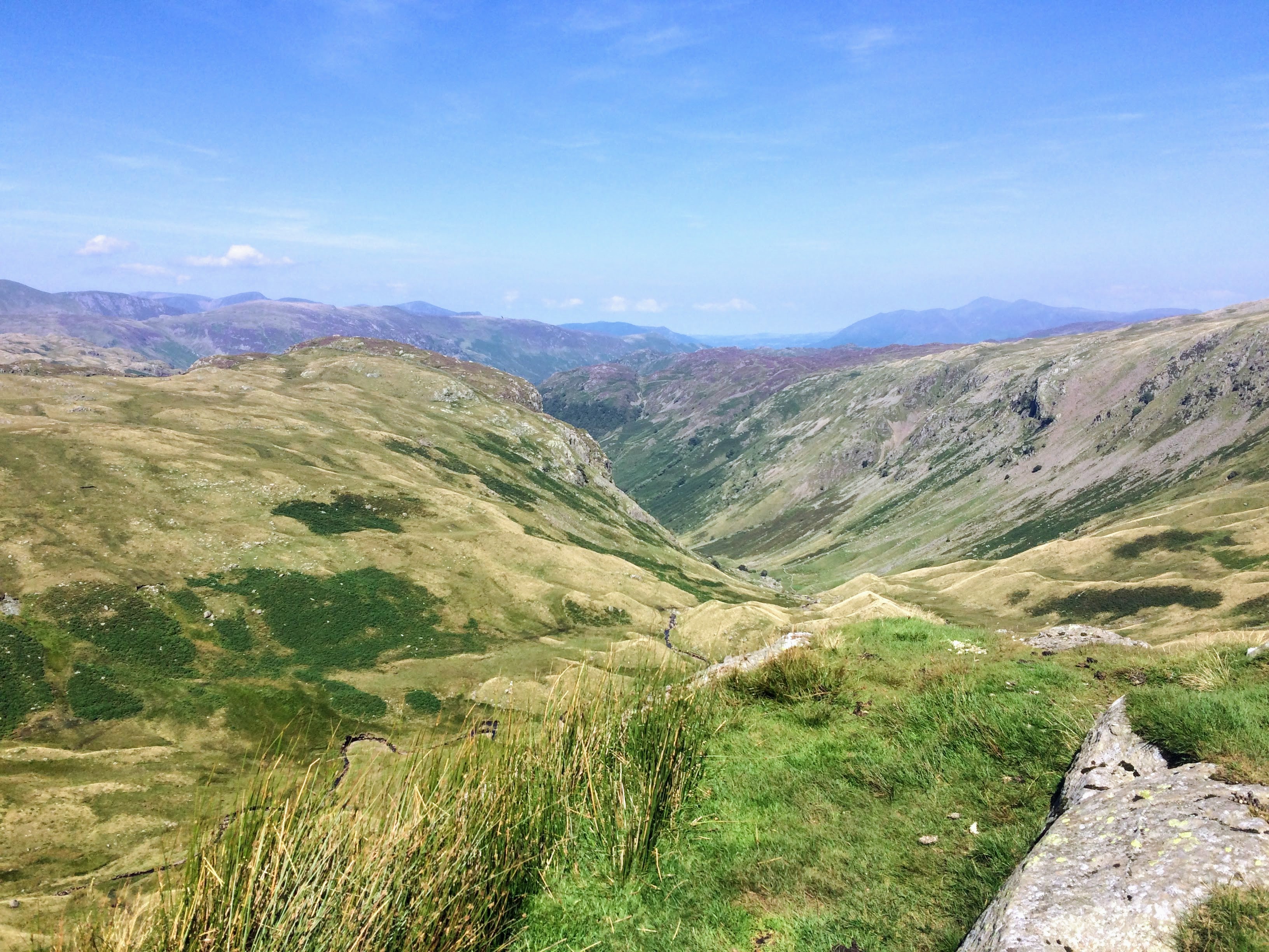
Greenup Edge is stunningly beautiful. I love how the landscape constantly offers something new; from the top, the valley below is covered in knobbly, grassy hillocks which look soft and inviting enough to roll down naked (although I didn’t).
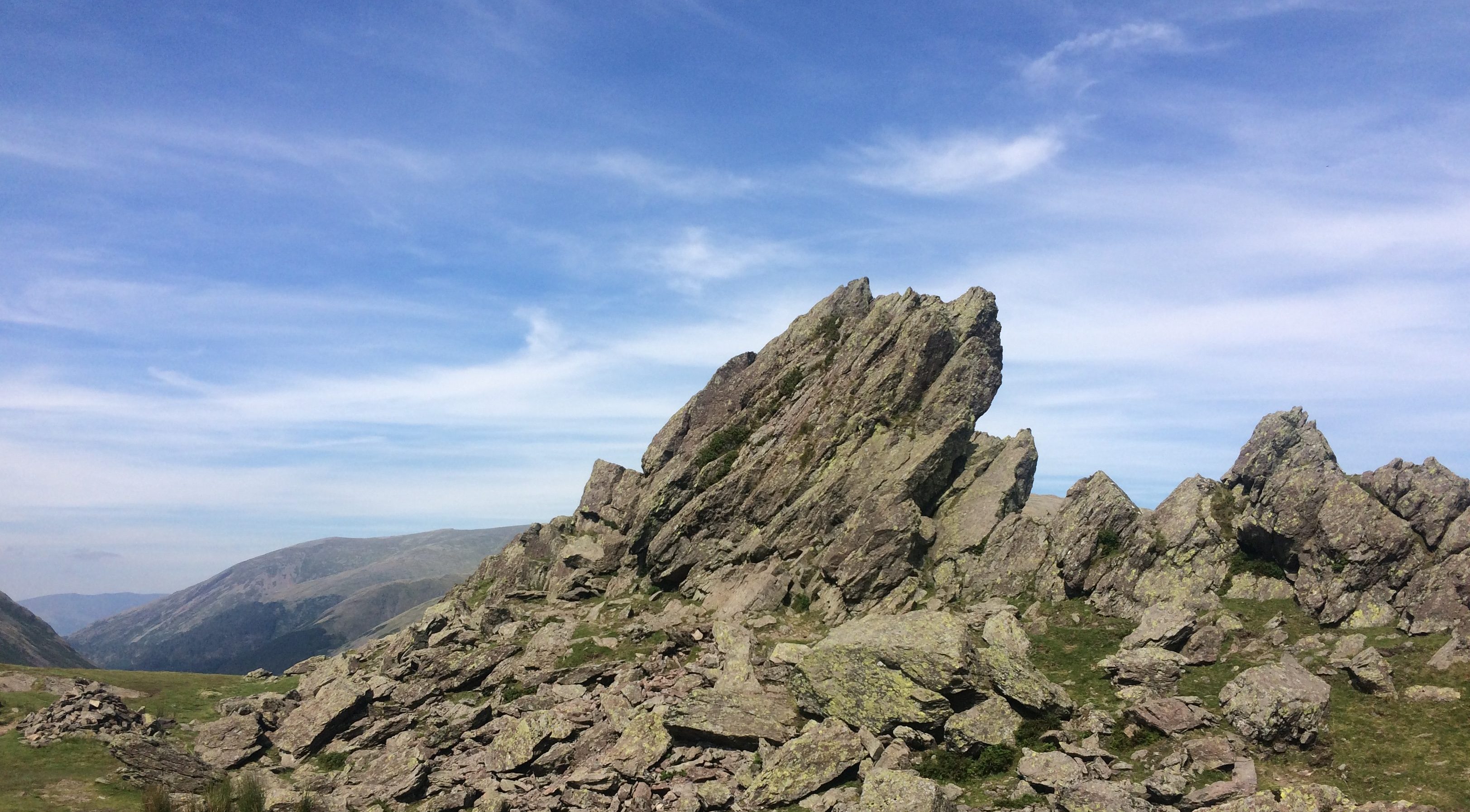
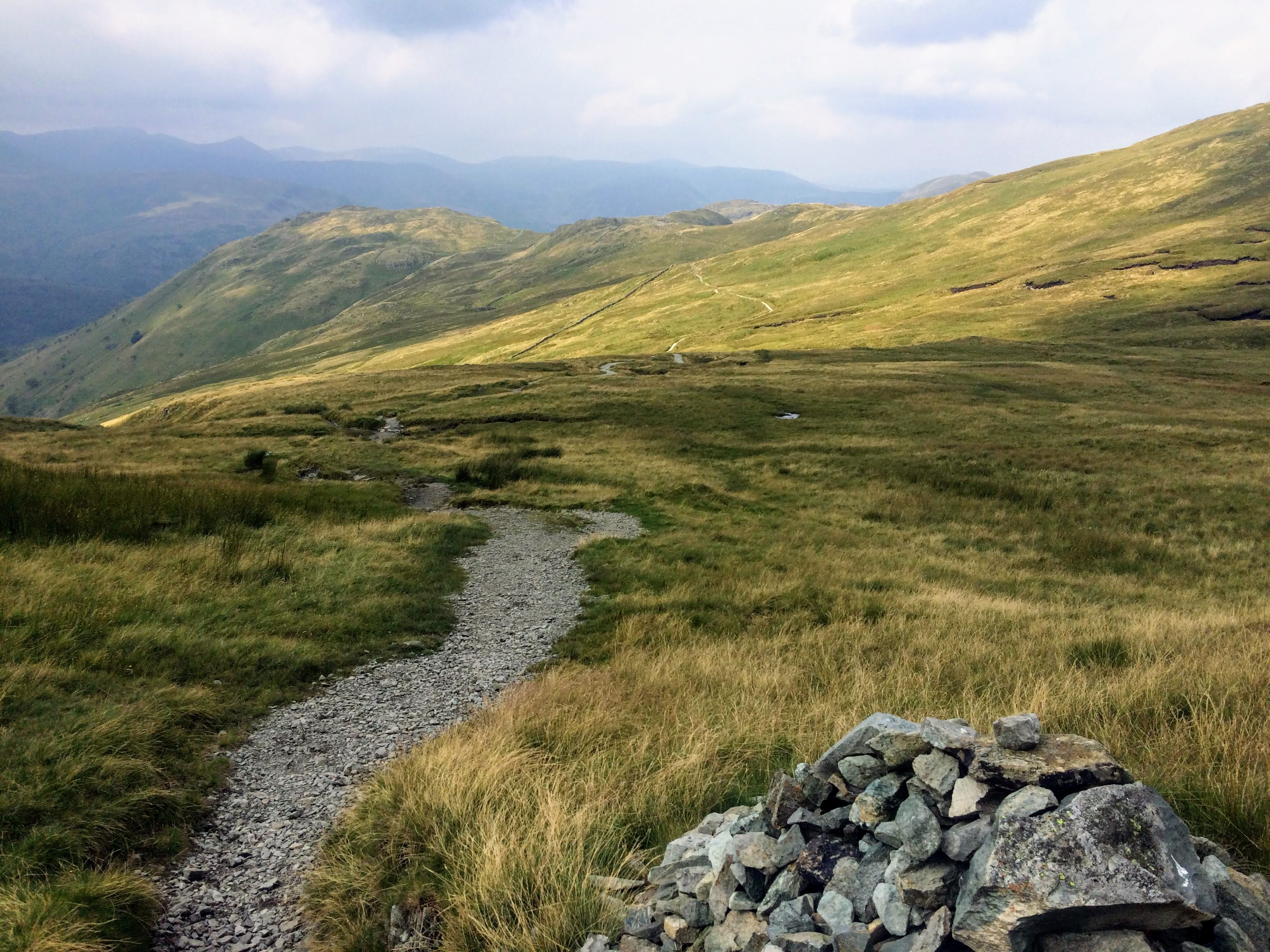
Further along there are two paths you can opt for – Helm Crag or Far Easedale Gill. I opted for Helm Crag, the tougher option – and tough it was. The long and complicated path undulates over and around rocks, pinnacles and craggy outcrops. My guidebook said this section of the trail was 7 miles; my pedometer 19 miles. All I can say is it felt like a long, long, long way. As I made the steep descent in to Grasmere, I knew I wouldn’t make it to Patterdale that day as it was already 17.30. The ice-cream a kindly American hiker bought me at the end remains one of the most pleasurable experiences of the trip.
The metropolis of Grasmere was full of tourists, outdoor shops and poncey cafes. I tried to find a campsite or bed and breakfast but it seemed the place was unable to accommodate me. Exhaustion was creeping up on me. Luckily, from nowhere, Roy appeared, like the shopkeeper in Mr Ben. He told me there was an independent hostel just out of town – Grasmere Hostel . This place is pretty good – clean, cheap, friendly and a stones throw from the start of the Coast to Coast path.
Day 4: Grasmere to Patterdale – 7 miles
The day started from more or less outside the hostel where I was staying. On the path a large flat rock ‘Alice’ has been scratched into it in huge letters which seemed strangely coincidental but I took as a good omen. The trek up through Tongue Gill is pleasant, passing a waterfall and then over the slightly challenging pass of Grisedale Hause, but then you are rewarded with the incredible sight of Grisedale Tarn.
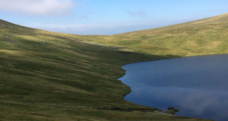
It would be easy to do Grisedale Tarn an injustice – coming over the pass to the sight of this perfectly serene, enigmatic and intensely blue pool of water was a moment of awe. Aside from the C2C path, there is nothing man-made near it, just the hillside swooping straight down to its shore. At the eastern end it seems to just disappear into the distant mountains.
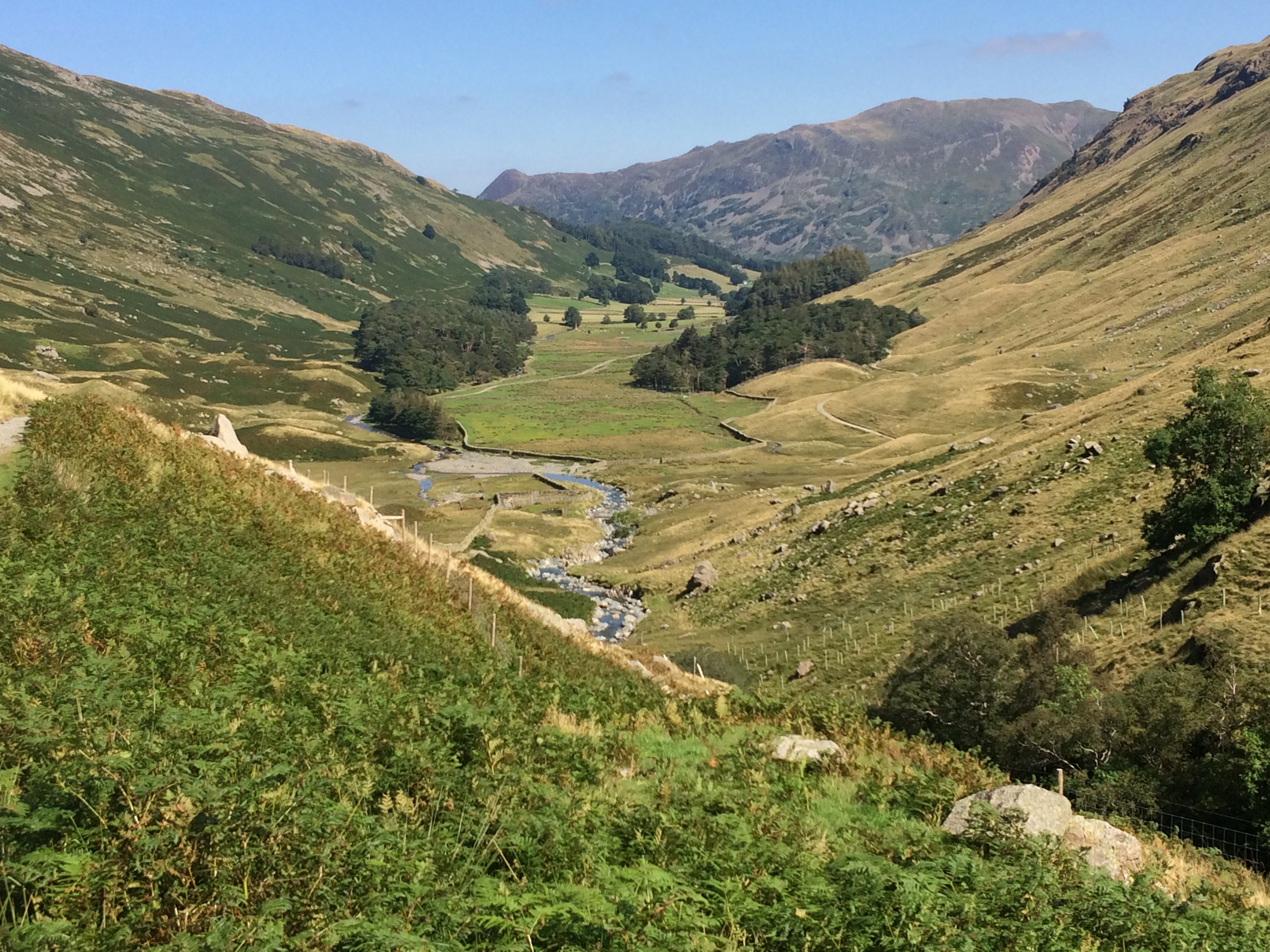
Splitting the journey from Borrowdale to Patterdale was a good move – hiking is for savouring the moment. I now had a whole day to cover just a few miles and one resounding memory of the entire hike was this slow meander down the beautiful Grisedale in the sunshine. In Patterdale I camped at Side Farm which looks over Ullswater and had dinner at the Travellers Rest in Glenridding. I bumped in Roy again and found out he had scratched Alice in the rock. Strange. Nice but strange.
Day 5: Patterdale to Shap – its a long way, don’t believe everything in your guidebook.
Along with many other hikers, I spent the first part of the day trying to find the start point of the Coast to Coast path which is very easy to miss and wasted almost an hour in the morning. Once going, it was a steady uphill to Boredale Hause and on to Angle Tarn which, like Grisedale Tarn, is a truly spectacular sight.
All was going well until at some point on top of Kidsty Pike I trod the wrong way a rock and twisted my ankle. It was really a small thing but the pain was enormous – how quickly and unexpectedly these things can happen. I cried (it was the shock I think) and swore and crouched in the path clutching my ankle for a while, realising I was alone on one of the highest peaks in the Lakes. I had no other choice but to carry on, aided by a large dose of adrenaline and many painkillers.
The descent to Haweswater is very steep and rocky, and quite a challenging walk down with a twisted ankle but I was more than compensated when an enormous herd of deer passed by. Along with a couple of fellow hikers, I sat in the hillside and watched them for about 15 minutes as they sprang through the bracken – such a beautiful, peaceful moment. Haweswater seemed endless; I felt quite elated as I neared the end, mistakenly thinking it would then be just a short hop into Shap. I was wrong.
This last section of the trail was gruelling but kinda funny; my guidebook reeled off endless instructions to go over this bridge, then that bridge, then though this field, over that wall, through that gate, over this hill, alongside that river, down this road, past that cow … I felt I was part of some strange puzzle. I was completely exhausted. Conveniently at the point where I ran out of water, an ‘honesty box’ with various drinks for sale appeared courtesy of Thomas Richardson aged 14. (Thanks Thomas!) By the time I got to Shap it was 20.30 and I’d been walking since 9.30. As I limped into the northern end of the village, the hostel/campground appeared right there in front of me – the relief was palpable.
This is a great place with lovely staff: The New Inn Lodge , and for dinner: Shap Chippy
Day 6: Shap to Kirkby Stephen
Not surprisingly I woke up with a painful swollen foot which was now an impressive deep purple; there was no chance I’d be able to walk to Kirkby Stephen that day. The staff at The New Inn served a pretty good full English breakfast and helped me organise a courier, normally used for transporting hikers luggage, to give me a lift to Kirkby Stephen.
Although I was a little disappointed not to complete my hike, it was pouring with rain and as I left Shap in the couriers minibus, I didn’t feel I was missing out too much. I had a nice chat with the driver as we passed through various villages to Kirkby Stephen – he wasn’t unaccustomed to rescuing injured hikers.
I had a prebooked ticket to London which I couldn’t change so the last day of my hike was spent drinking tea and a slow hobble around Kirkby Stephen in the rain which was fairly uninteresting. I had dinner at the The Black Bull Hotel with a couple of C2C walkers I had met in Patterdale (the food was average and bizarrely there is Jackie magazine wallpaper in the ladies).
Day 7: Kirkby Stephen to South East London – 276 miles

It is possible that the beautifully restored station at Kirkby Stephen is the best thing about the town. I took the train to Leeds through the Yorkshire Dales which looked pretty fabulous even in the torrential rain, and then home to London.
This first section of the Coast to Coast path is a stunning, immersive journey into the Lake District’s fells. Knowing a little of the area, it’s beauty did not surprise me, but it’s ever changing terrain, the serenity of the tarns, the 360° panoramas, floating birds, wild heather and the absolute peace was more mesmerising than I could’ve imagined.