
In June 2019 I set off on a 155-mile hike through the incredible islands of the Outer Hebridies: Vatersay, Barra, Eriskay, South Uist, Benbecula, North Uist, Bernaray, Harris and Lewis.
These islands are more than just beautiful, they are enchanting, and the experience of travelling them was a revelation. The locals are subtlety inquisitive and speak with an irresistible soft, Scottish lilt; words seem to flow out of them, but gently, like a babbling stream rather than gushing rapids. The sense of community here was uplifting and, although I would not normally advocate women hitchhiking solo, I felt completely safe taking lifts from fellow visitors and locals. It wasn’t only a convenience, but enriched my experience of travel and understanding of the community.
I think a good film is a journey through the emotions, each scene constructed with beauty and precision; hiking the Hebridean Way is a similar experience. The slow rhythm of putting one foot in front of the other allows you to fully absorb the protean landscape, wildly dynamic as it mutates with the ever-changing weather. As the terrain and the elements collide, it is easy to lose yourself in the visual and kinaesthetic beauty of everything which surrounds you. If it isn’t obvious, I absolutely loved this place.
My Itinerary
| Day 1: Vatersay to West Kilbride (South Uist)
Day 2: west Kilbride to Howmore (South Uist) Day 3: Howmore to Liniclait (Benbecular) Day 4: Liniclait to Carinish (North Uist) Day 5 Carinish to Lockmaddy (North Uist) Day 6: Lochmaddy to Bernaray |
Day 7: Day off to walk around Bernaray
Day 8: Bernaray to Horgabost (Harris) Day 9: Horgabost to Drinishader (Harris) Day 10: Drinishader to Bowglas (Lewis) Day 11: Bowglas – Laxay (Lewis) Day 12: Laxay – Stornoway (Lewis) |
Places to Stay in the Outer Hebrides
My advice for hiking the Hebridean Way
- Embrace the wind, the rain, the mist, the sun; this is an ever-changing landscape
- Never trust the weather forecast – it must be impossible to predict weather which changes every 5 minutes
- Develop the skill of bog leaping and appreciate that even the most waterprooof boots will be tested to their limits
- Shops are often closed on Sundays and there are not many shops/restaurants cafes en-route; however you may be pleasantly surprise by some pop-up food vans placed in wonderfully appropriate places
- Although the Cicerone guidebook says it is a temperate climate, I am pretty sure the guy who wrote it wasn’t camping. Take a very warm jacket for night – in June it was still incredibly cold at night even with a -3 sleeping bag, mat and thermals to sleep in. I took a fairly thick down jacket and think I would have given up the hike without it
- I didn’t bother with maps as there were too many for the area covered. I took the Cicerone guidebook and downloaded the route on my GPS app (Viewfinder) which was a lifesaver, although not in a completely literal sense
- Don’t be a purist. If your feet are sodden, you have blisters upon blisters and the path is a concrete causeway for the next few miles, just take the lift that some lovely local is offering you. The conversation and window into the locals life will make it worth your while
- Take a day off and walk around the perfectly formed isle of Bernaray
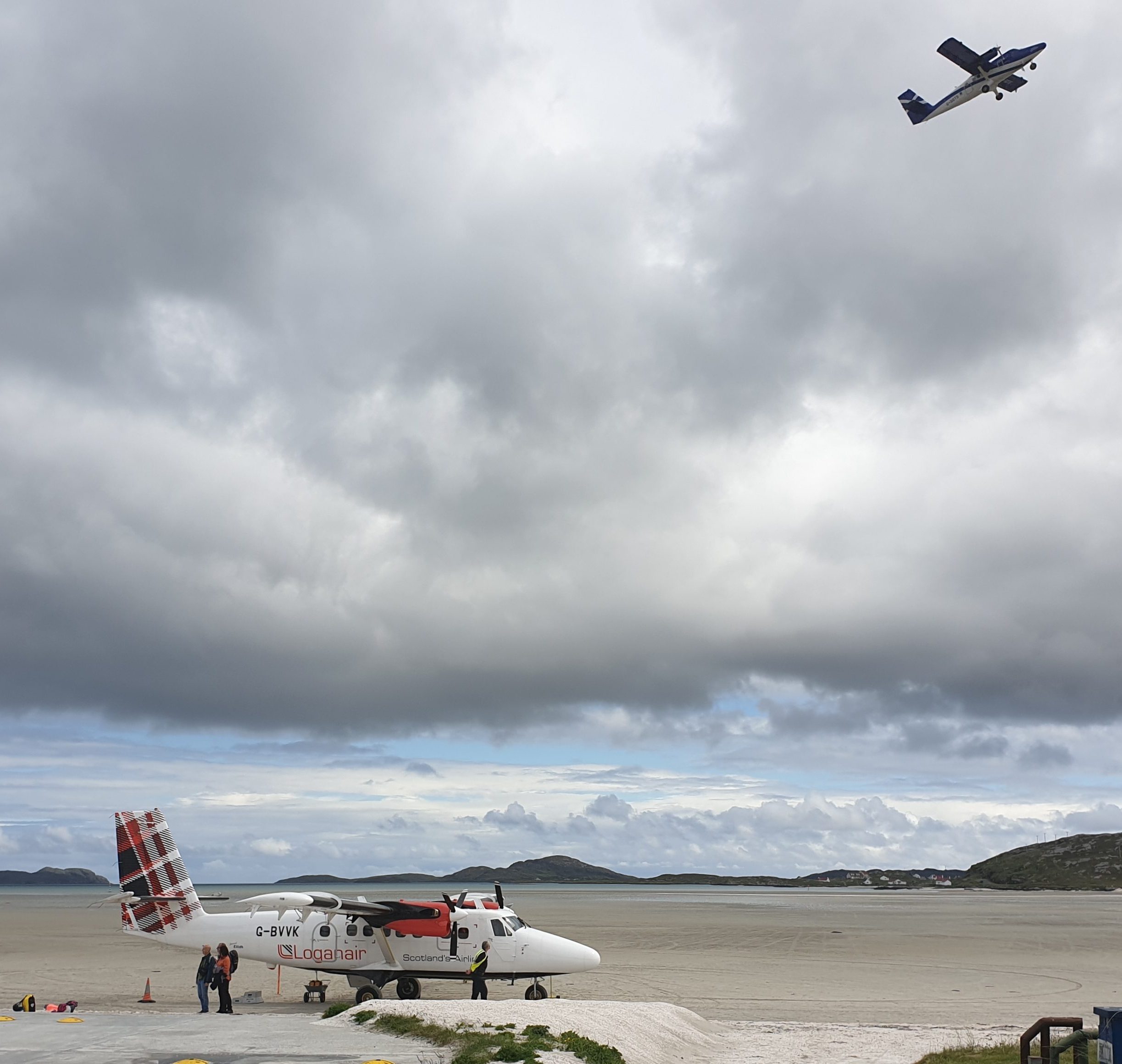
Barra is the only airport in the world which uses the beach as its runway. It is also the only aeroplane I have been on where the passengers took more than a cursory glance at the emergency landing card – not that this was necessary; we descended over the twinkling waters of the Sea of Hebrides to a smooth landing on the silver sands of Barra. There were fifteen (ridiculously excited) tourists, and a couple of locals – apparently they keep a few seats free for the Barra natives who may need to leave the island (although why you’d want to, I do not know).
I have wanted to take this journey for a long while – it is a very special way to arrive in the Outer Hebrides. You need to book early to get a seat on the plane – I reserved mine in January for a flight in June and even then it was starting get full. It cost me about £350 for returns flights: London – Glasgow – Barra / Stornoway – Glasgow – London.

The Machair
Lush, expansive grassy plains abundant with wild flowers – in late June when I was there it was glowing gold with celandines and peppered with marsh orchids. It is lovely to walk across although I took two lifts; one from a farmer across a field of cows and their young, and one the last mile or do to Howmore Hostel.


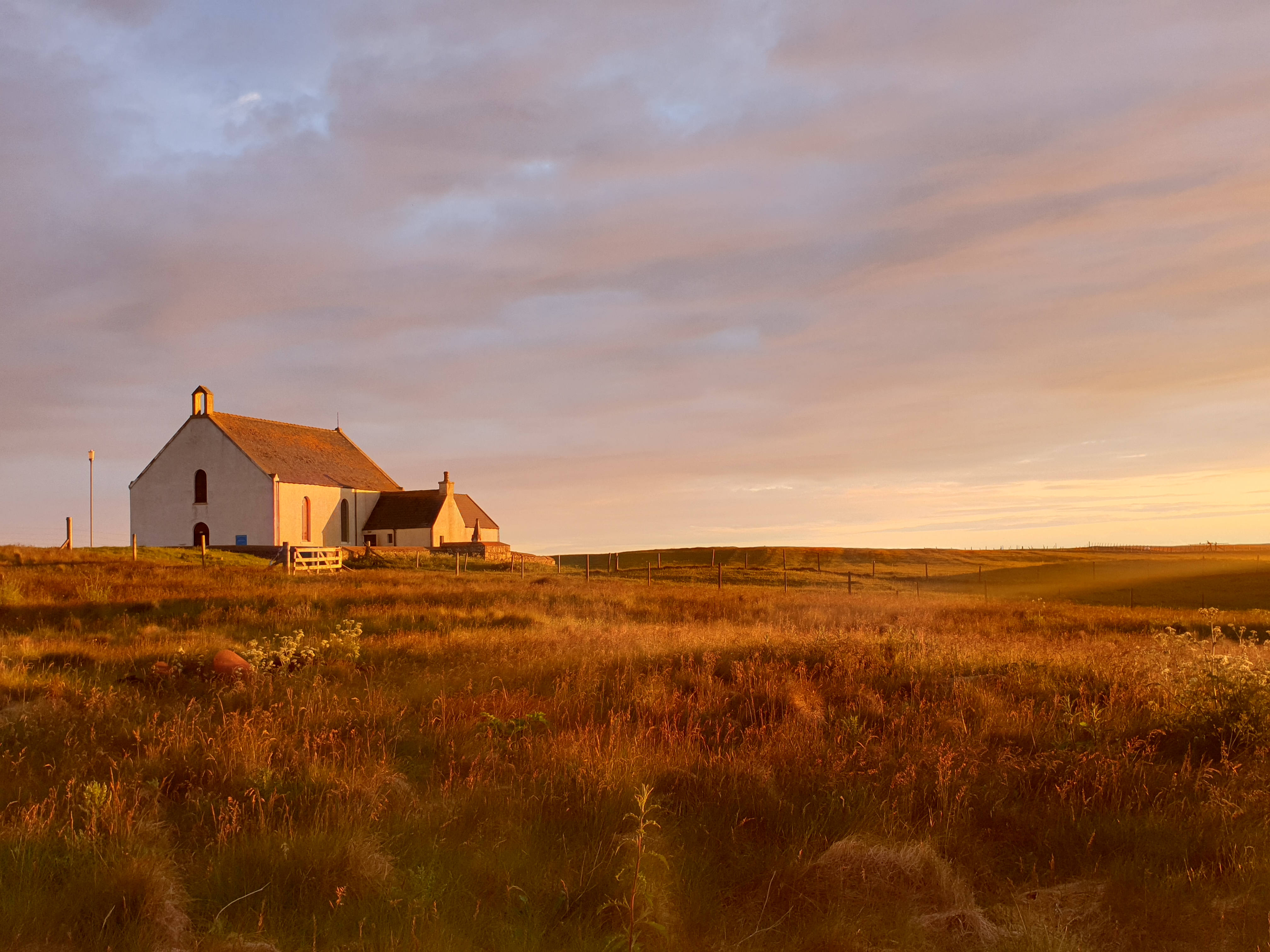
South Uist
After a restless night being pelted by rain and a 40 mph wind until 4am, it was a joy to walk along this deserted beach of silver sands and deep green sea. The only company I had were birds were swirling around me in the wind – oystercatcher, redshanks, plovers, curlews. This must be where choreographers get their inspiration.

The Gatliff Trust owns three charming hostels in the Outer Hebrides. I camped in the grounds of the Howmore Hostel under a rainbow in a beautiful golden evening light; and again at Berneray Hostel, a beautiful location on the beach, looking out towards Harris.
There were a few lost souls at Berneray Hostel. I know this is what travelling is about sometimes; maybe we are all looking for some kind of transformation through our adventures. This was a great place to meet fellow travellers but there were some people there using the hostel as location for their disengagement from life. I didn’t want to judge, but I didn’t want to spend the evening drinking whiskey with them either.
")
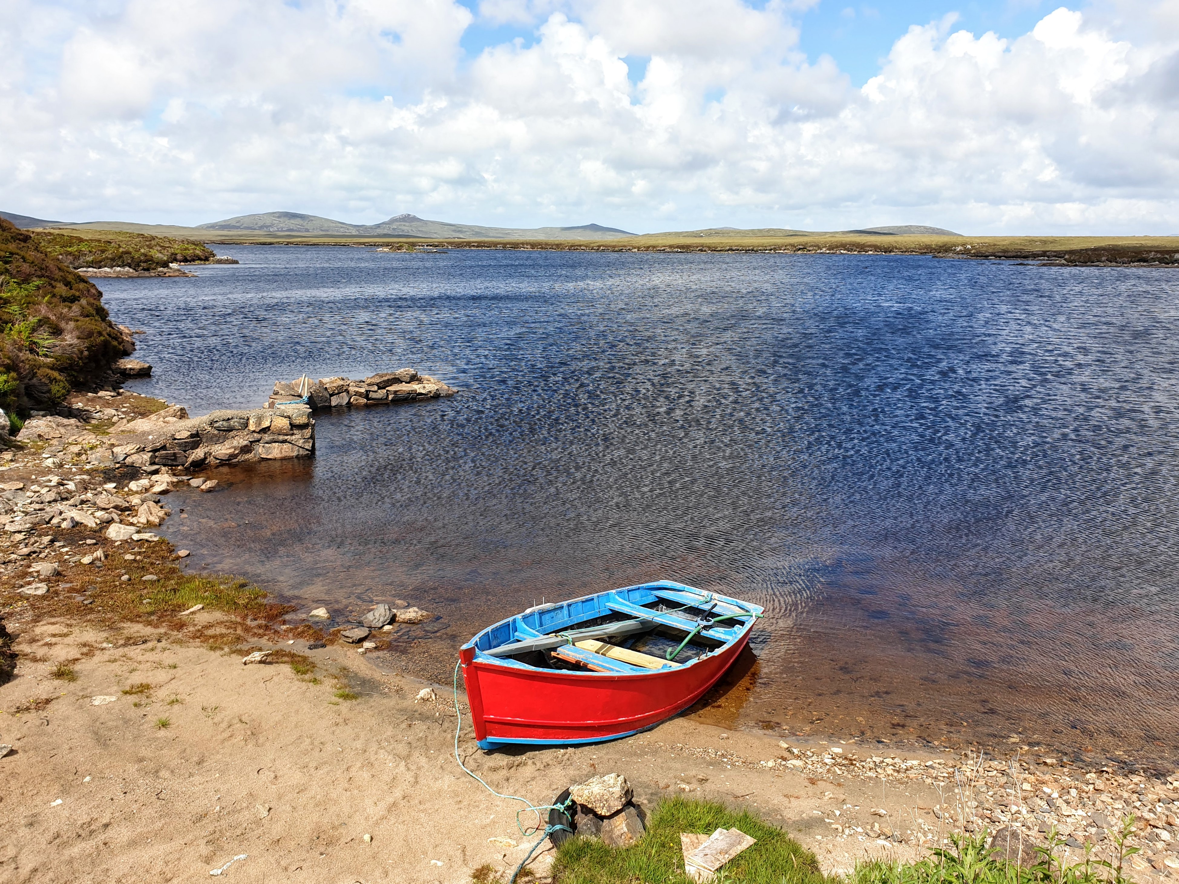
Benbecula
Benbecula is flat, but not featureless. Mount Rhubhal is only 124 ft but it is the highest point on the island. The land below pocked with pools of water which glisten in the sun. On this day the patterns in the land seemed to be reflected in the sky; you can see the many shapes and colours dancing across the vista. There was something about this lonely spot which I found mesmerising – it had a strange hotch-potch kind of beauty to it. The hike down was hard work, leaping through bog on scrappy land. When I reached the road, I had a long walk across the causeway to North Uist but the nice woman I met on my way up Mount Rhubhal stopped in her camper and offered me a lift. Much as I’d love to be a purist, my feet were drenched and I was developing blisters upon blisters.


Leverbrugh to Horgabost
The day started with the two-mile walk from Berneray Hostel to the ferry terminal, and the 45 minute journey over to Leverburgh. I stocked up with some food at the local Co-op and set off along the path to Horgabost. All was well at first but in the latter part of the day, the path disappeared and the terrain was not only boggy but very uneven, tufty ground with small undulating hillocks. It was hard, hard work. Once I could see the bay and the campsite, I decided to go off piste and make my way across some flooded fields. My feet were drenched, but I finally limped in the campsite looking forward to a dehydrated camp food of pasta al funghi until before me, like a mirage, like a gift from the Gods, a fish and chip van shop stood.
It was here that I met a group of guys who had passed me the previous day. They were hiking the Hebridean Way with day bags while one of their dad’s drove their gear from camp to camp. One of got me a beer – while one of them explained to me how I was doing it all wrong, that my pack was too big and my (carefully researched super lightweight tent) was too heavy and I’d never get up the hill of the next section…
Luskentyre Beach
True enough, the next day started with a very tough hike up a very steep hillside covered in rocky outcrops. My pack was pulling me backwards so it was a slightly precarious journey up but I did it, and this was my reward:

And this is why I hike – you don’t get views like this from the road; neither do you get the same experience of the sun and wind, the emptiness of the landscape, and removal from any civilisation and human contact. There wasn’t another soul in sight from up there. I sat on a rock, drank my coffee and felt the breeze flow through me.

The Coffin Road
Despite its sombre name, The Coffin Road is another joyous section of the Hebridean Way, especially after the wet, pathless terrain from Leverburgh to Horgabost. How lucky we are to enjoy this path now: After the clearances of the 19th century, this was where bodies were transported back to their homelands to be buried. Many of the displaced, those who didn’t emigrate to America, started new lives on the rocky east coast.
Everything seems to change as you pass over to the East side, it seems to hold a different atmosphere, different terrain, different birdlife. The east coast is peppered with art galleries – some good, some not my taste. I explored it after I completed my hike with the help of a hire car. My favourite was The Mission House Studio


My last two days were spent wild camping on Lewis. I felt very alone, but not lonely. These last two days were in parts, across some very desolate moorland. It felt the sky was sitting a foot above my head and I didn’t meet another soul. Arriving in Stornoway was celebrated with a beer in a seedy bar – but I was ecstatic.