
The West Highland Way is a 94 mile long distance trail which runs from Milngavie on the outskirts of Glasgow to Fort William. The path journeys from industrial edgelands into desolate heathland, alongside the seemingly endless Loch Lomond, through forests and valleys, across the wilderness of Rannoch Moor into Glencoe before winding its way through some of the most beautiful lush hillsides in the eye of some enchanting Munroes of the Highlands. With each step the landscape unfolds into an ever more enticing and imposing terrain, concluding a stones throw from the base of Ben Nevis should you fancy an additional challenge at the end.
Milngavie – Drymen: 12.5 miles
Drymen – Rowardennan: 15 miles
Rowardennan – Beinglas: 13.5 miles
Beinglas – Tyndrum: 11 miles
Tyndrum – Kingshouse: 20 miles
Kingshouse – Kinlochleven: 9 miles
Kinlochleven – Fort William: 14 miles
My adventure…
In the spring of 2016 I decided I was going to walk the West Highland Way. Up until that point, I hadn’t been particularly interested in hiking but the convergence of various events and thoughts somehow brought me to the idea. As it turned out, it was one of my better decisions, opening up a whole world of new landscapes to explore, and the incredible sense of freedom which belies in carrying everything you need on a pack on your back.
According to my Cicerone West Highland Way guide book, ‘… it would be foolish to even think about setting off if you have not previously done any rough walking or had to carry a heavy pack.’ A friend had suggested that I perhaps just ‘go for a walk’ to see if I liked it but I by the time I had booked a flight to Glasgow, and slowly bankrupted myself buying ‘gear’, I didn’t have much time to do any training, try walking with my pack on my back or properly break in my boots (I did do a seven miles walk in Kent but managed to fall down a rabbit hole and twist my ankle). This may all sound a bit foolish but it all worked out perfectly.
Day 1: Milngavie to Drymen
The industrial fringes of Milngavie are the backdrop to the first section of day one, not the most aesthetically appealing of landscapes, but after all my preparation, my apprehension, a cancelled flight (which meant a I started a day late) and a strong desire just to get out of London and away from Brexit hysteria, it felt fabulous to get going.
About half way, it started raining and didn’t stop for next seven miles of my walk and most of the night. The only person I spoke to was a Donald Trump lookalike who somehow persuaded me to part with some money in aid of Mountain Rescue (for the record, nobody collects money on the trail in aid of Mountain Rescue or any other organisation, as I later discovered).
My over-excitement in starting the hike slowly dissipated into an anti-climax. The rain was relentless, my pack was getting heavier and heavier, and my ‘waterproof’ boots were not waterproof. On the plus side, a stoat with a mouse in its mouth trotted along the path, which made me smile, and I had some glimpses of the trail’s wild beauty that would roll out before me as the trail continued.
The sight of Drymen Camping was very welcome and although run down and neglected, it was open for business. There was a huge barn for cooking and drying out clothes and generally keeping out of the way of the rain. Some walkers were playing cards and a man was staring at a laptop (Really? Here? This is just like London). As it happened he was a very pleasant, genial chap – and perhaps just a little eccentric.
He told me that, after experiencing a mid-life crisis, he decided to cycle around the UK. So off he had set from his home town in the south, with a trailer attached to his bike, for a year-long adventure around the UK. Having reached Newcastle he decided he would learn all about ‘survival’ for his onward trip into Scotland. However, he got distracted after accidentally discovering he had a natural penchant for karaoke. After spending three weeks in Newcastle indulging in his new found passion of live singing, he moved on into Scotland with the burning ambition of cycling the West Highland Way. Clearly this was not a well thought out plan as the trail is not built for cyclists, but fate was kind to him: As he cycled into Milngavie, he fell off his bike and broke his thumb (not so kind) but, a woman came to his rescue and as luck would have it, they fell in love and moved in together.
Spontaneity! Thank you Mr Mid-Life-Crisis, you made my day.
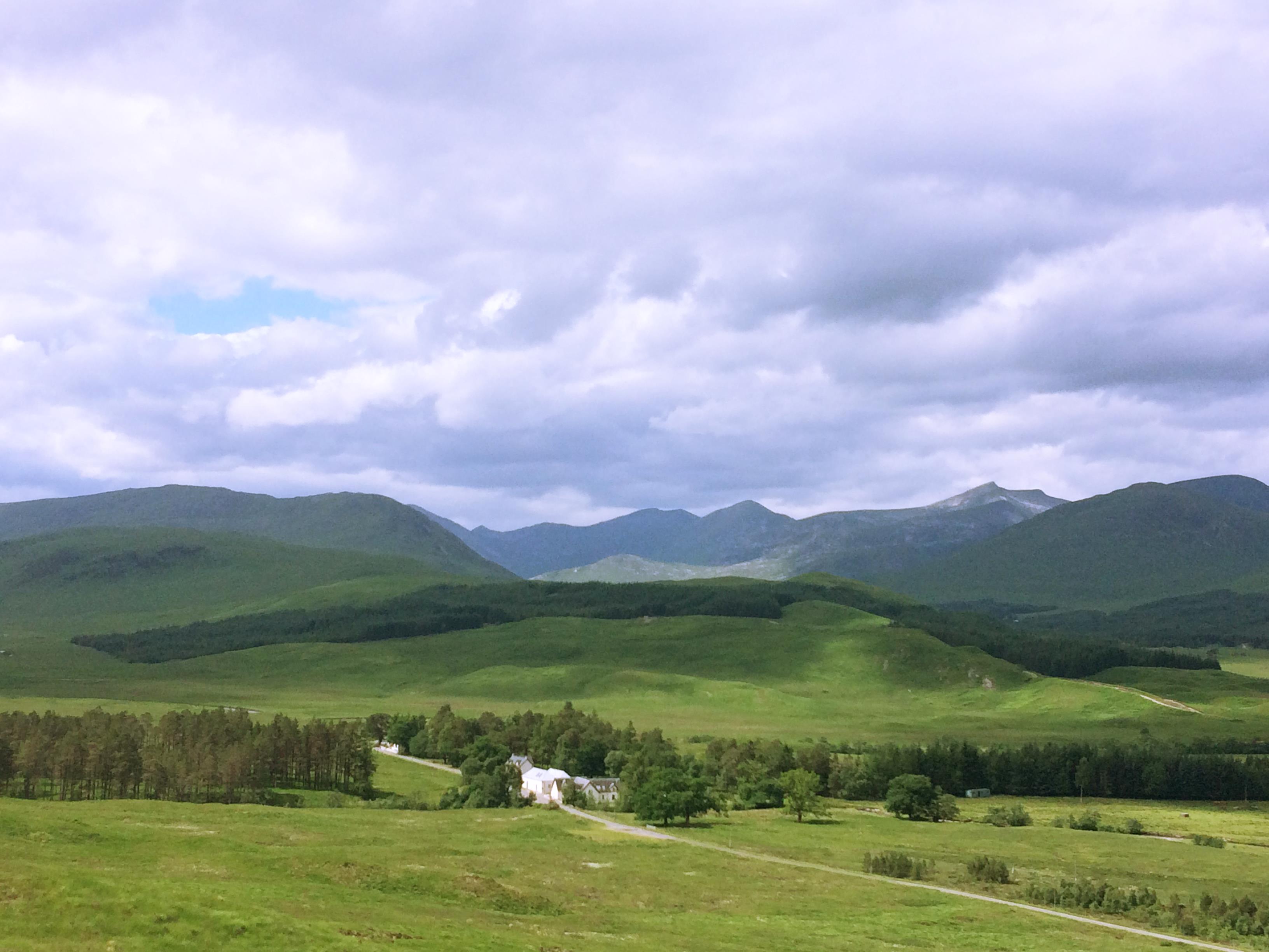
Day 2: Drymen to Rowardennan – 15 miles
After a very wet night, I discovered, thankfully, that my tent was waterproof. I began the day with a walk into the village of Drymen and had breakfast at the Drymen Arms – an establishment which wins my award of the worse food of the trip.
I (very bravely) walked through a field of ferocious Scottish cows and followed the trail up to Garadhban Forest (which seemed more of a wild heathland than a forest).
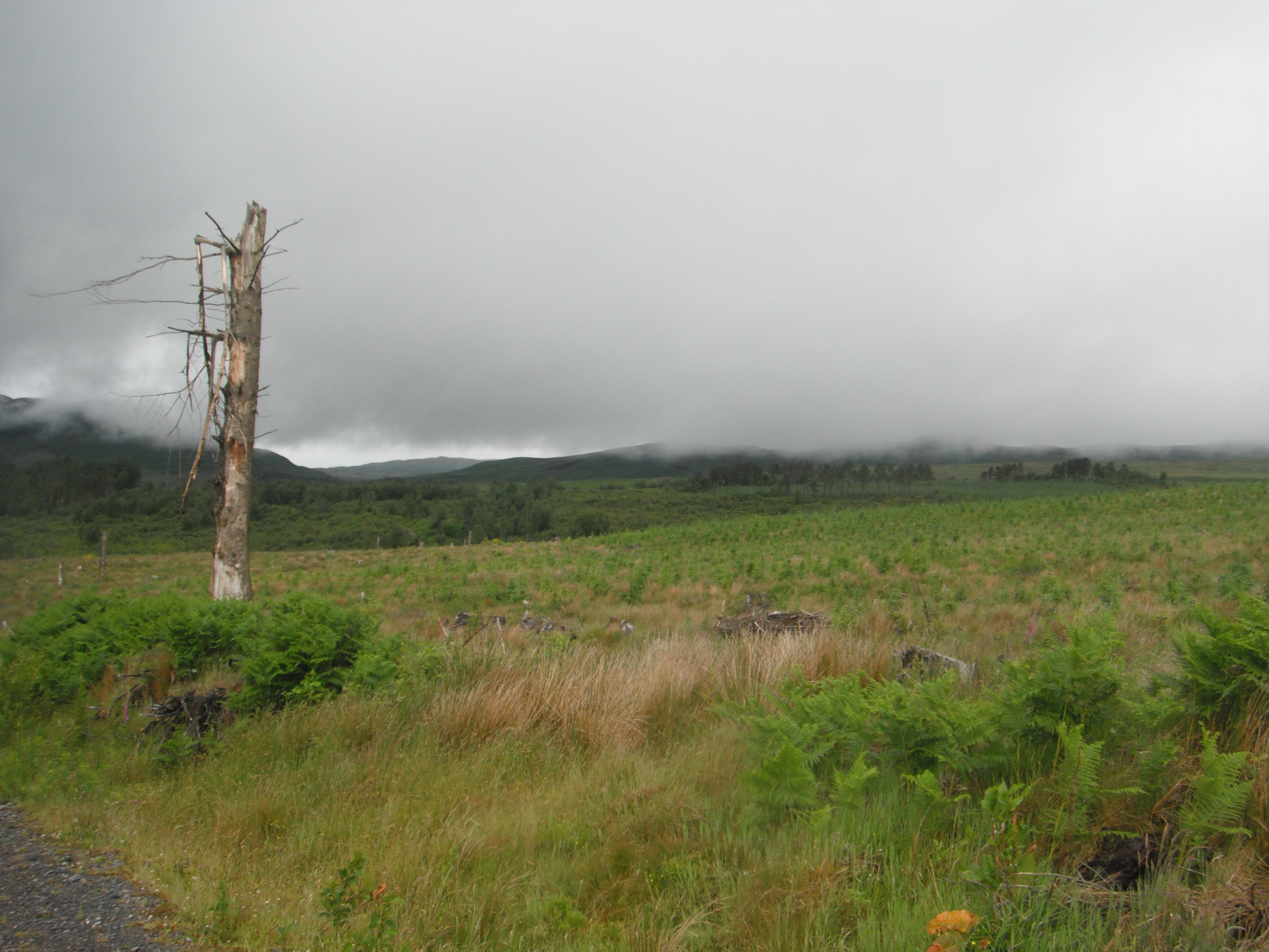
Up on Garadhban I could see Loch Lomond – a vast, granite grey mass sitting below a low lying swirl of mist. The heath was exposed and desolate, covered in windswept bracken and dead trees with rotten limbs hanging off their trunks (I mean woody limbs, not human ones) – a terrain in perpetual conflict with the elements. It felt brilliantly desolate up there with not another soul in sight.
Back down at loch level, the path twists and turns through a forest of Elm, Oak, Beech, Willow, Alder, Larch and Scots Pine. It felt quite serene after the wasteland of Garadhban. In Wildwood, Roger Deakin writes that woodland people can identify the tree by the sound of the wind blowing through its leaves. In Wild, Jay Griffiths talks about how the Inuit read the landscape through sound – the howl of the wind whipping around glaciers, the creaking and crunching of ice shifting, the burble of sea squeezing through holes in cave walls and ice moving above the changing tides. The terrain is in perpetual motion and knowing the sounds is essential for survival (you should be ok in this forest though – but its a great place to just listen).
I’m sure a seasoned walker would not struggle much with this fairly unchallenging 15 miles but I was exhausted. This was by far the hardest day of the trail; my pack felt heavy, my shoulders hurt and my feet were wet, so when I reached Rowandennan Hotel I couldn’t help but pop in to see if they had a room available. And they did. After a long, blissful shower, I found the restaurant and ordered stag pie and chips and a large glass of Malbec – all was well.
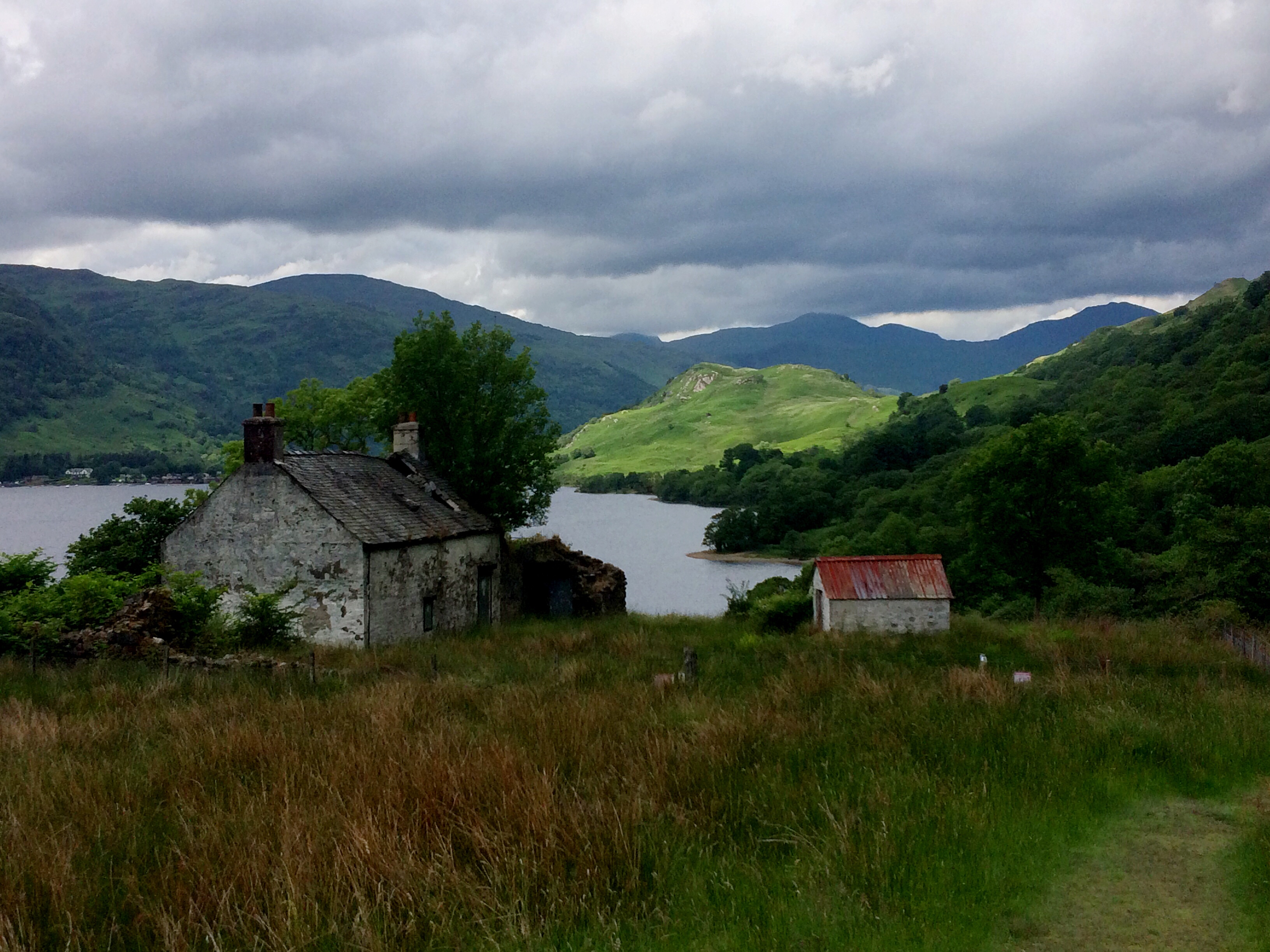
Day 3: Rowardennan to Beinglas – 13.5 miles
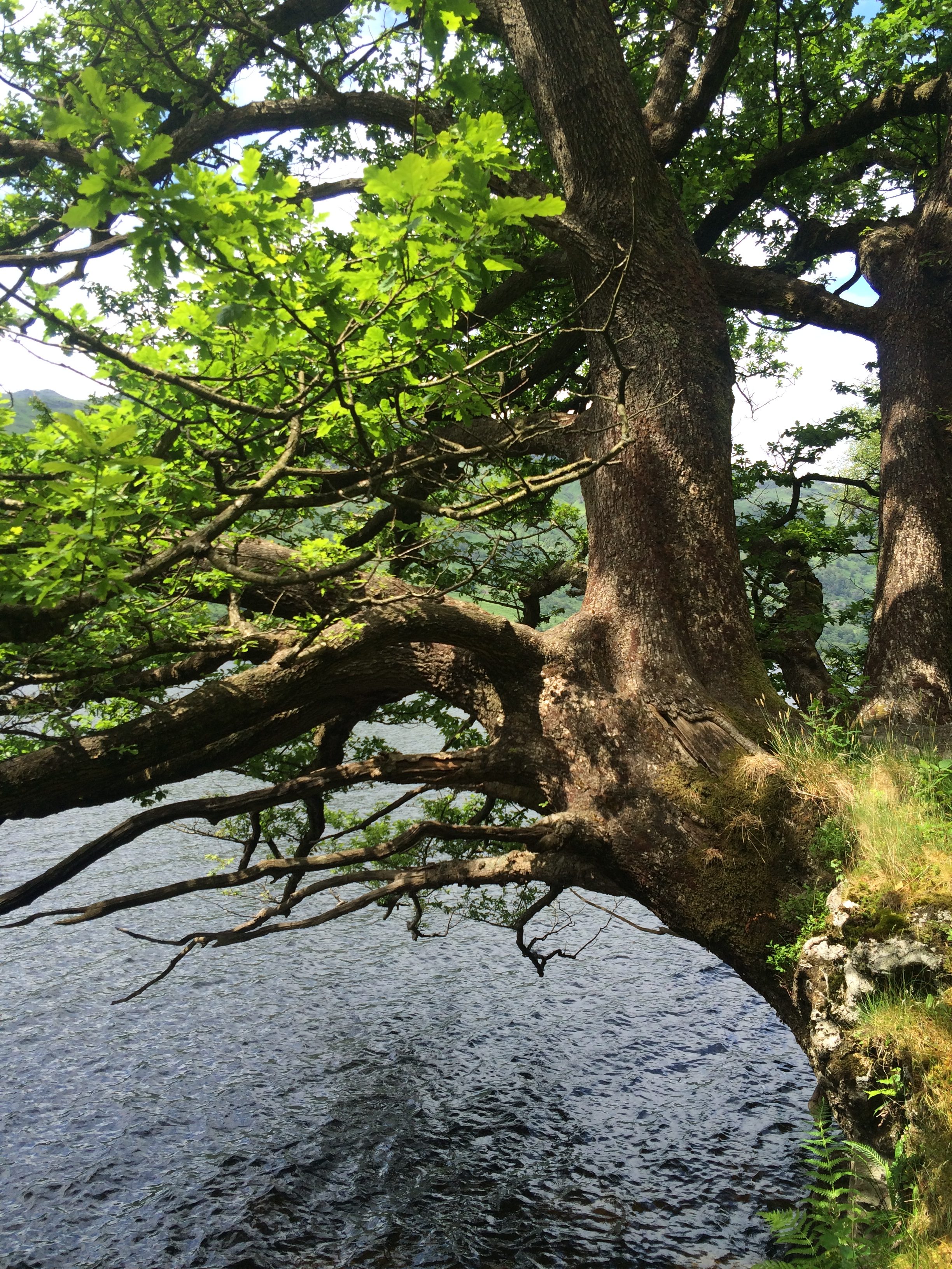
The trail continues alongside the never ending Loch Lomond. It’s beautifully peaceful with nothing but the sound of wind in the trees and streams trickling into the loch to fracture the silence.
At some point the path becomes very rocky – this is certainly the most challenging part of the trail. As I discovered, scrambling over boulders and shimmying down rock-face is enormously fun. My pack provided further challenge as the weight pulled me unduly one way or another; it would be easy to lose balance and find yourself tumbling down a gully or into the loch itself. At one point a Swiss man did indeed fall above me at a point where the path split into two levels. His rucksack and the top of his head were about a foot above my eye level and he appeared to rolling further over in slow motion. I stuck my arm out to try and prevent him from tipping over the edge and on top of me but luckily he stopped there, and not long after regained his composure and got up; all was fine – the next time I bumped into him was in the whiskey shop in Fort William.
Although I had intended to walk much further, a fellow hiker had recommended Beinglas Farm as a pretty good place to stop for the night. On the negative side, I had my first experience of the horror of Scottish midges; on plus side the Beinglas bar has stone walls, wooden beams, affable staff and I believe the food was good but as I was so hungry and exhausted I think more or less anything would have hit the spot. This is a great place to meet hikers and have a few drinks.

Day 4: Beinglas to Tyndrum – 11 miles
The day started with a breakfast of Scots Porridge, at least that is what they claimed it was; my guess is that it was just phlegm served with honey. Two mouthfuls was more than enough. I bought a take-away coffee for my thermos, a mosquito net and some bread and cheese at the campsite store and set off on the 13 mile walk to Tyndrum.
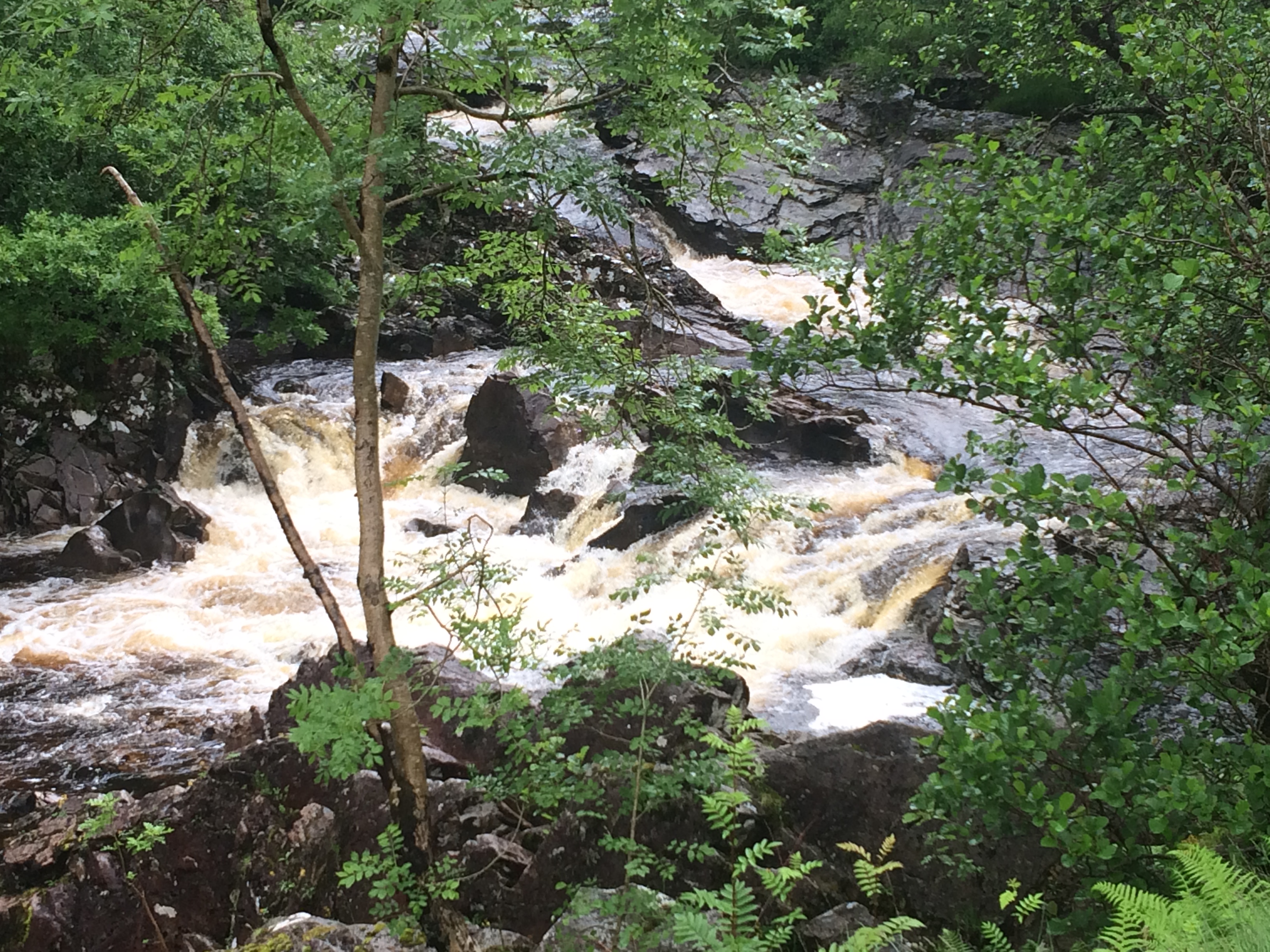
The path passes through Glen Falloch alongside the lively river Falloch where the fabulous roar of the water rushing over the rocks emits an almost palpable energy. It’s worth taking some time out to enjoy the cathartic impact of its bellow. I was feeling pretty happy, even the incessant rain was fading into insignificance and by this fourth day the meditative impact of walking was seeping into me.
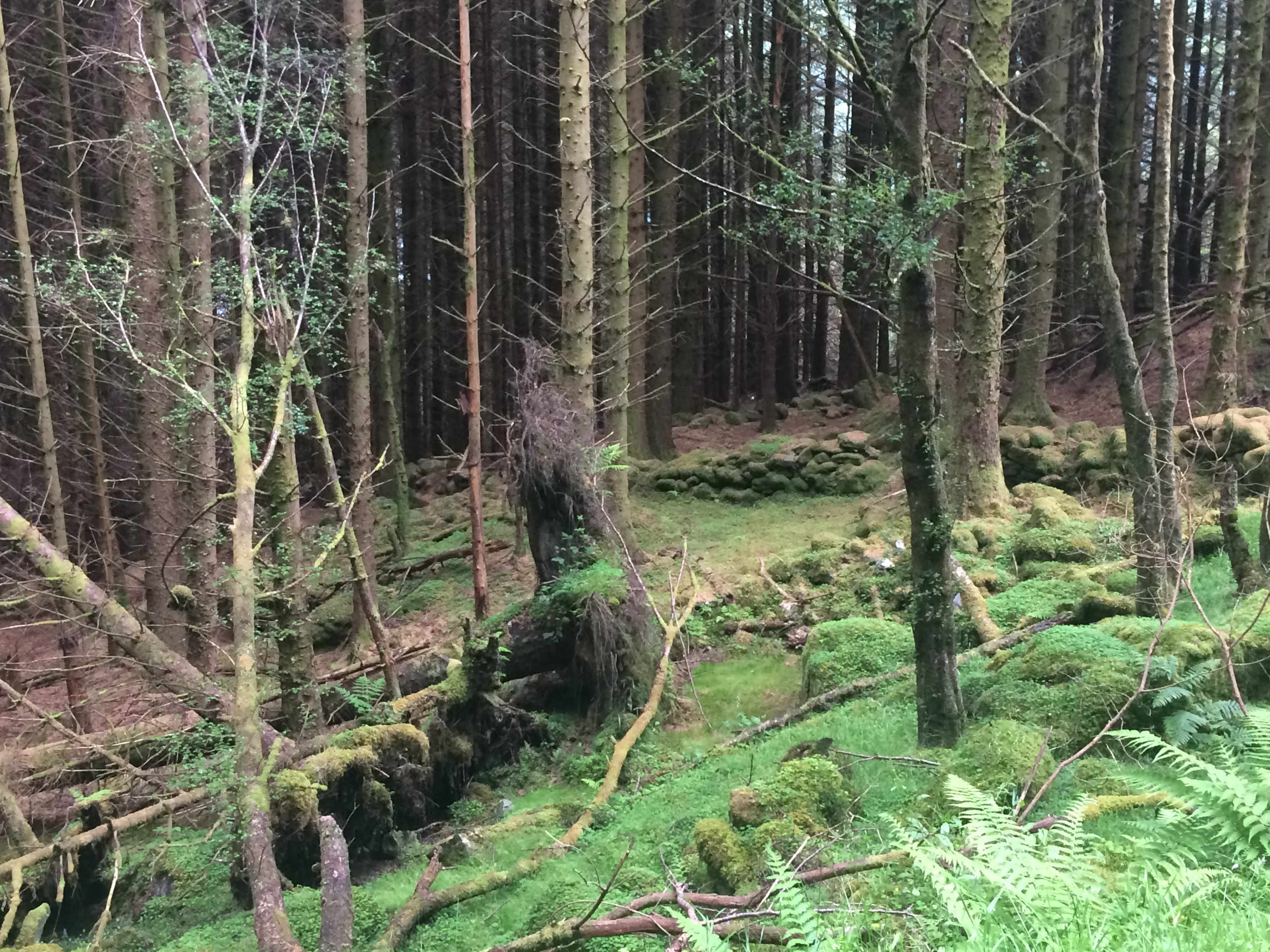
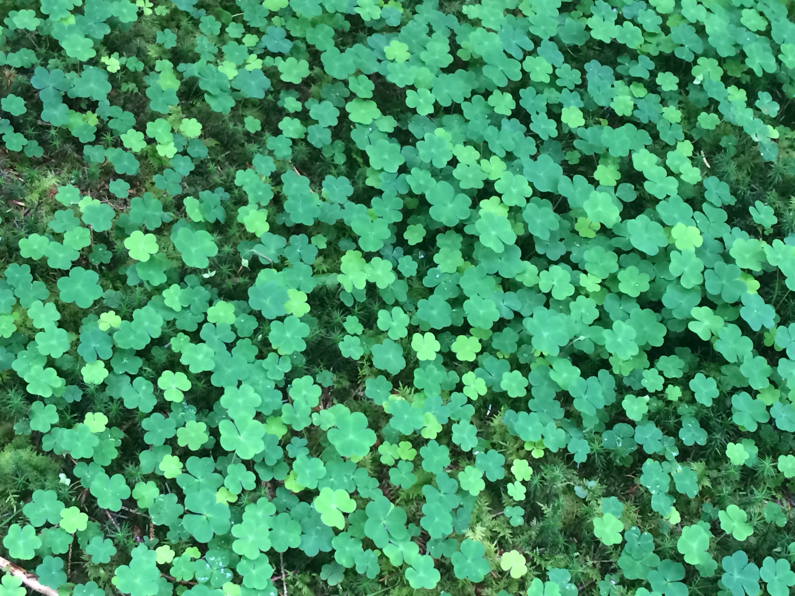
The trail weaves through the gently undulating terrain of a forest of pine trees. Despite the grey rain-clouds looming above, it felt exceptionally warm. The forest floor was carpeted with ferns and moss – a sumptuous deep green peppered with crystal raindrops. As the path dipped down, the sudden amplified humidity felt like it was emanating from the vegetation – a lovely antidote to the rain and mist.
There are two campsites at the end of this section, Pine Trees and By the Way camping – the proprietor of the latter wins my award for the worst customer service on the trail. Tyndrum village is not particularly interesting** or pretty but there is a shop there that sells absolutely everything. I was told there are two main places to eat in the village: the pub (http://thetyndruminn.co.uk/) and the fish and chip shop (http://www.therealfoodcafe.com/). I chose the pub but I wish I had gone to the chippie.
**Aside from the fact that it is built on the site of a battlefield where my very own clan, the MacDougalls, defeated Robert the Bruce in 1306.

Day 5: Tyndrum to Kingshouse
Yesterday the path had seemed busy; today the path seemed almost deserted. I walked through a field of ferocious looking Highland cattle but they just sat in the grass staring and munching grass and didn’t appear to have any interest in me whatsoever.
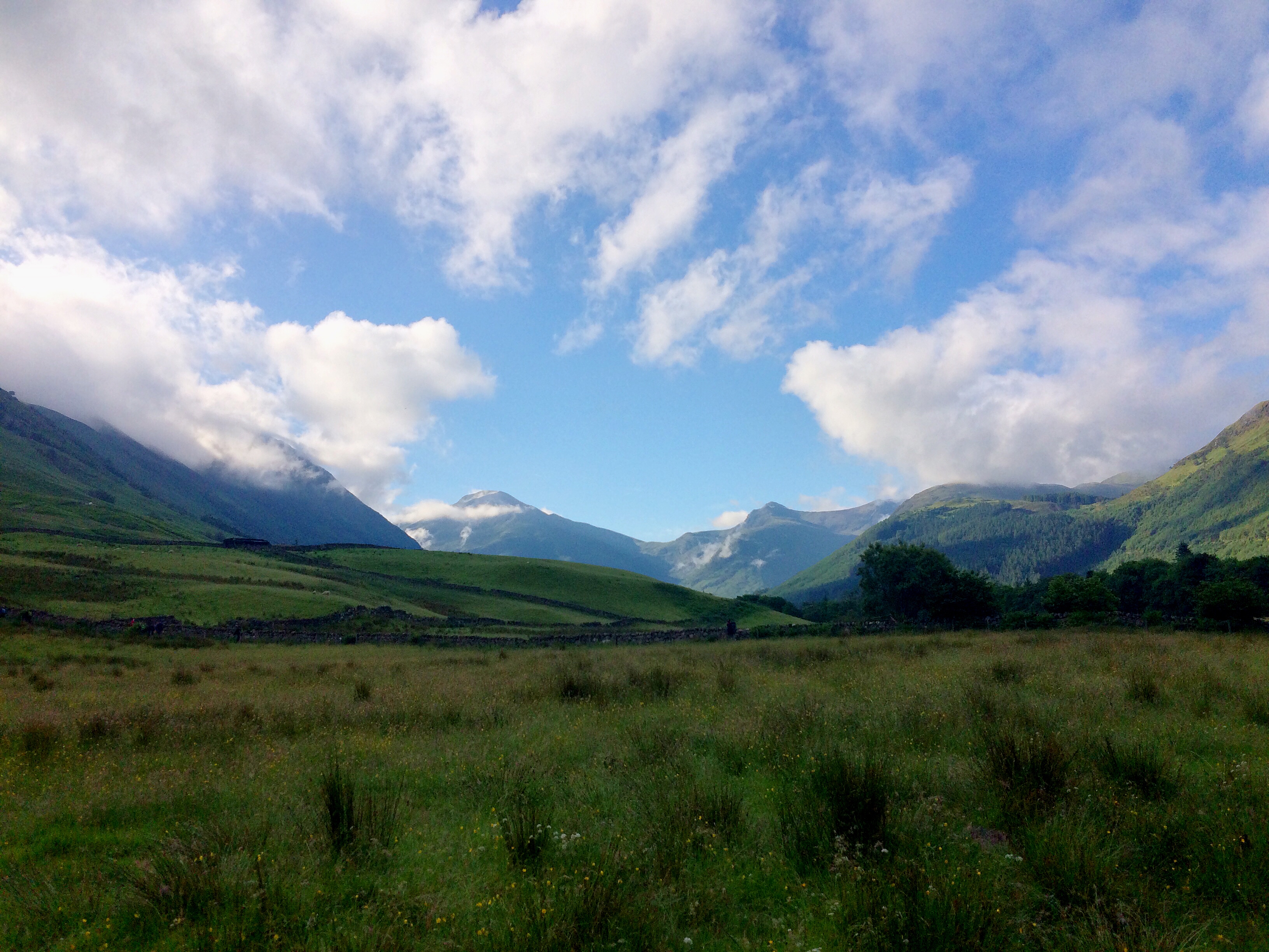
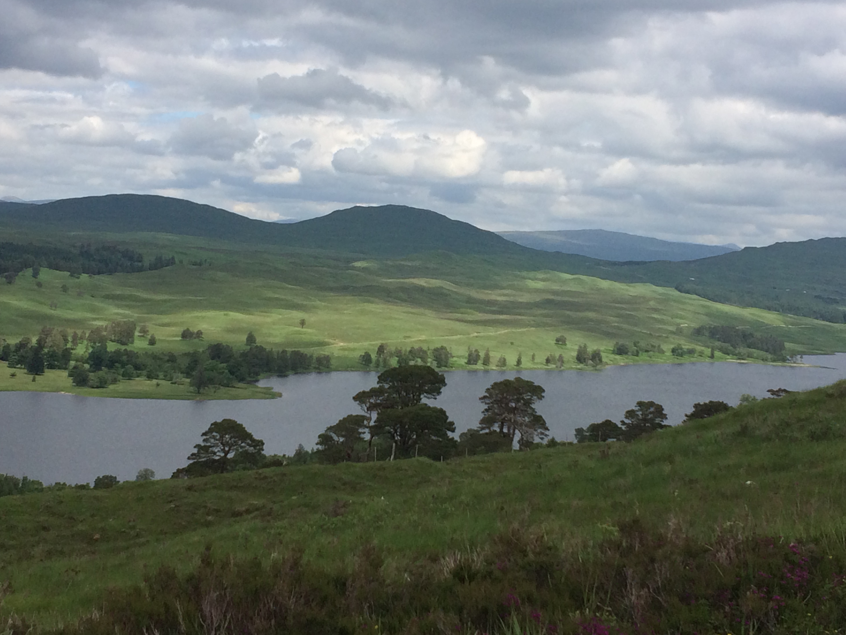
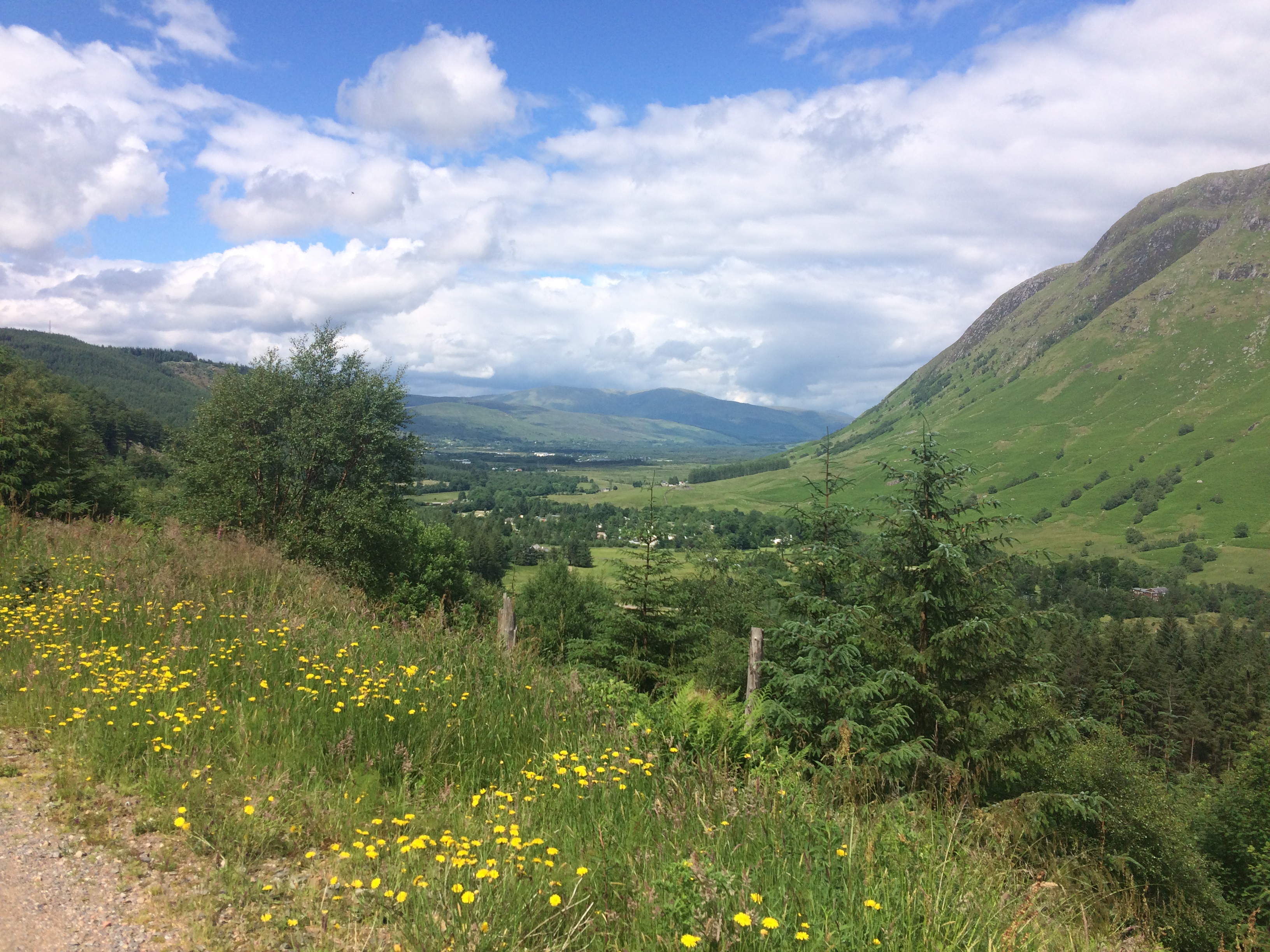
Past the Bridge of Orchy, over the brow of the hill, you are faced with this view which my dad also snapped when he did the WHW in the 1980s before anyone had ever heard of it (except him of course). There was a heatwave when he did hence why the grass is scorched yellow.


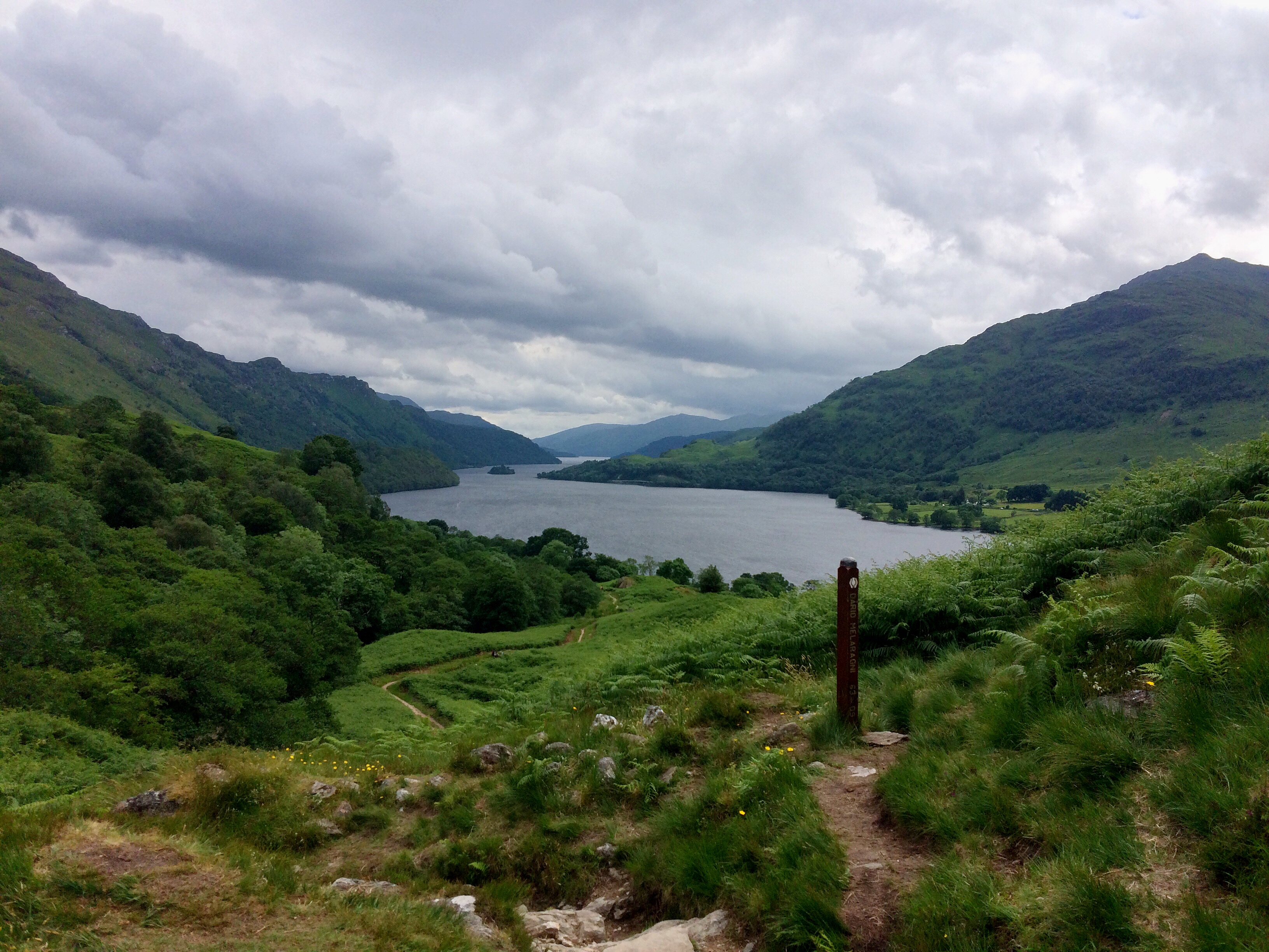
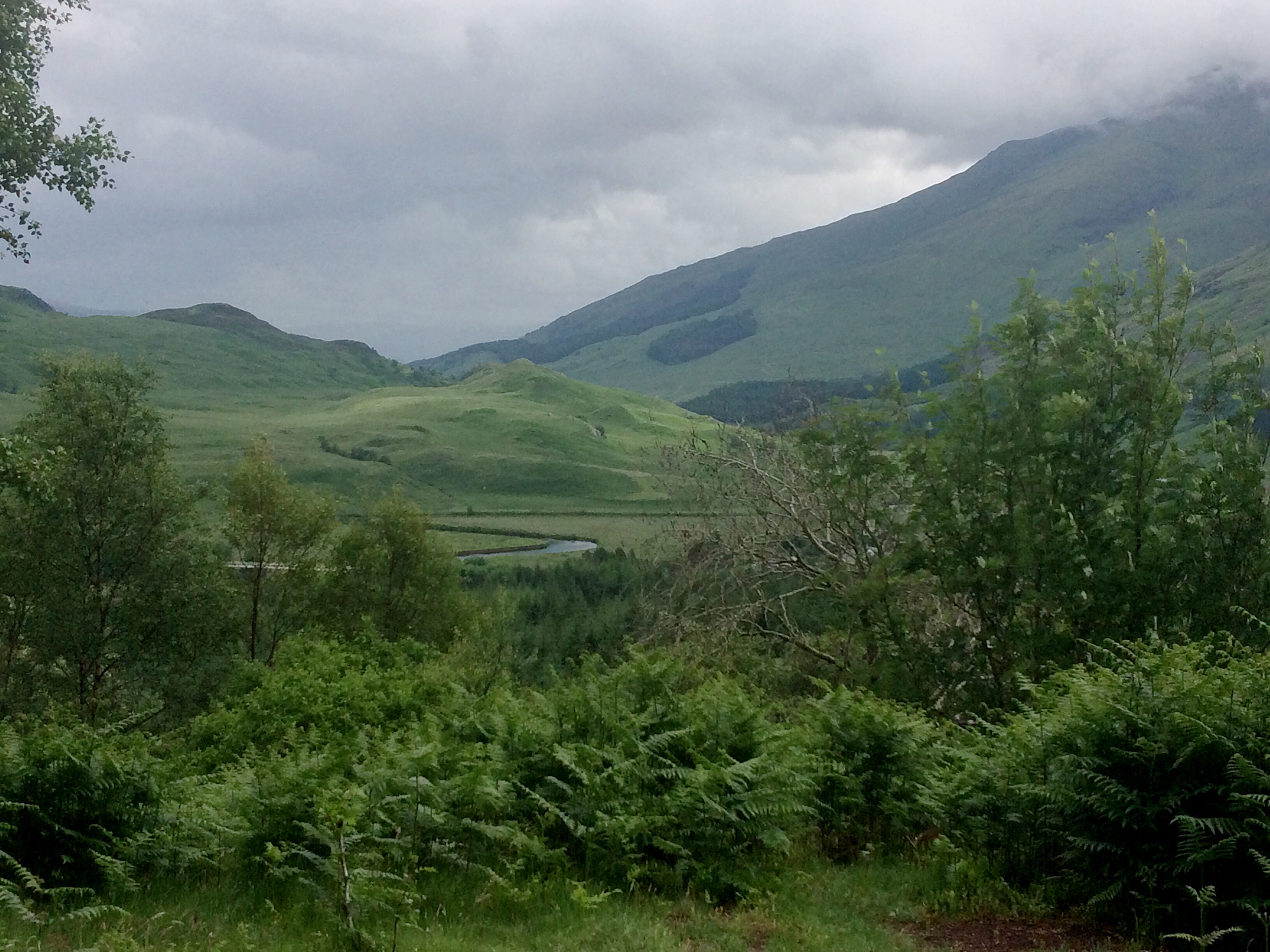
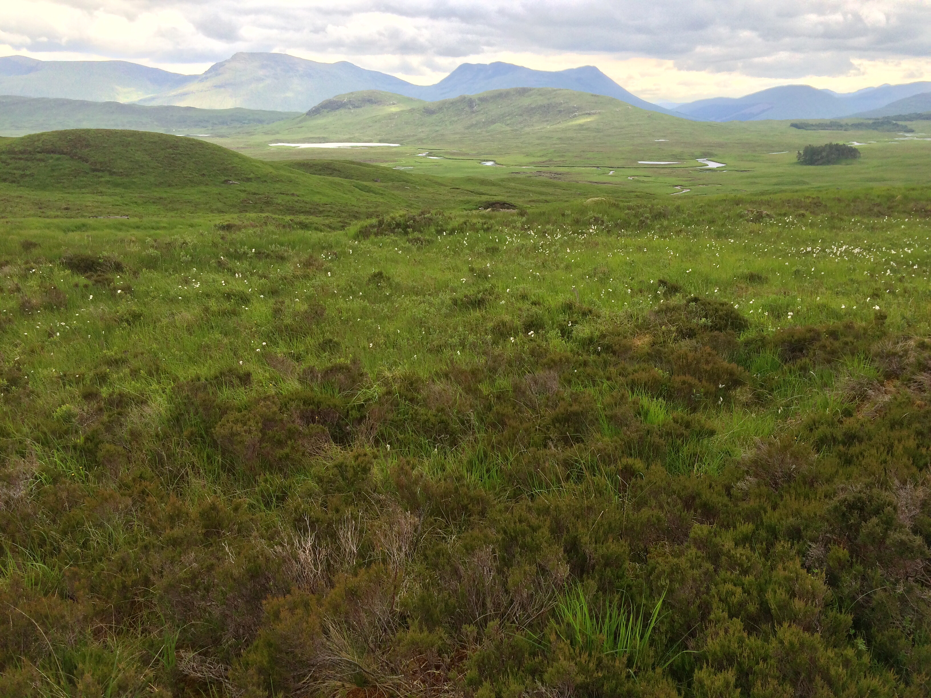
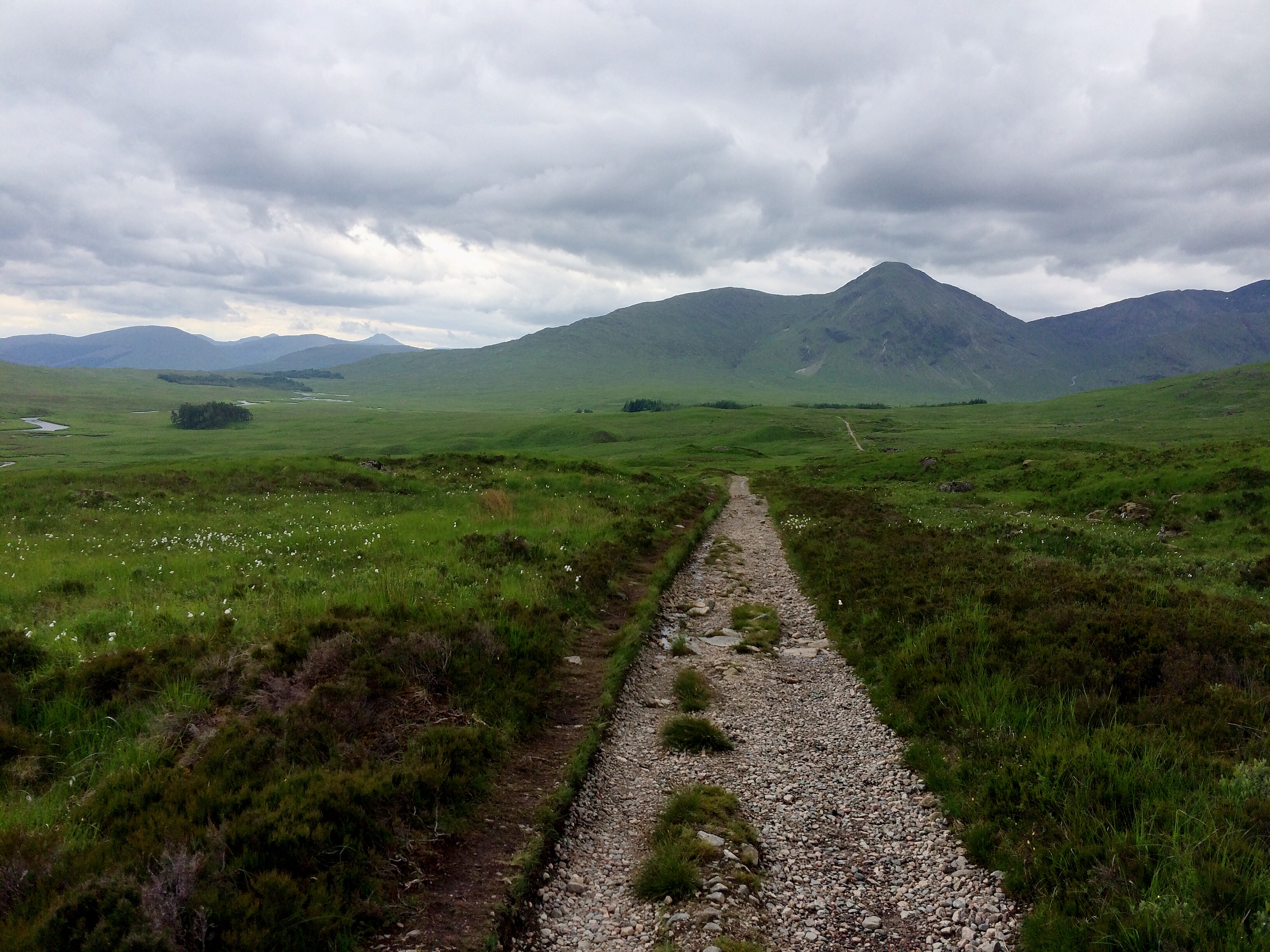
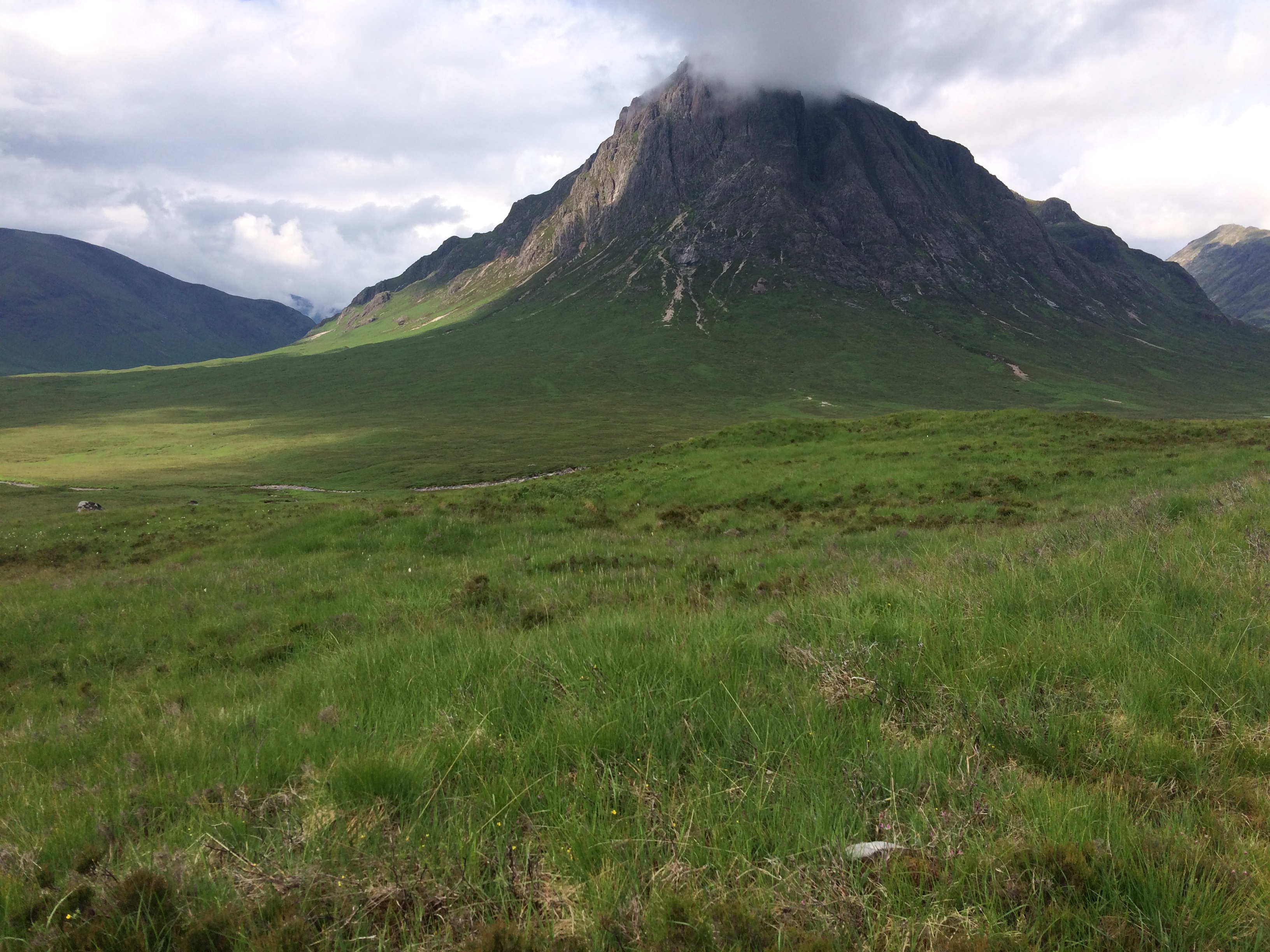
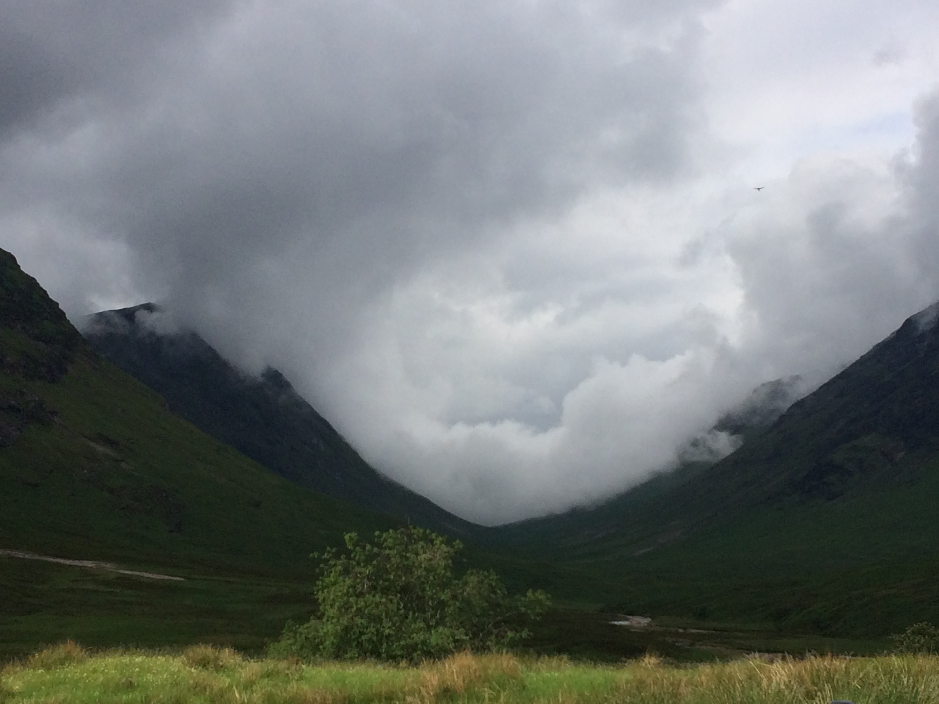
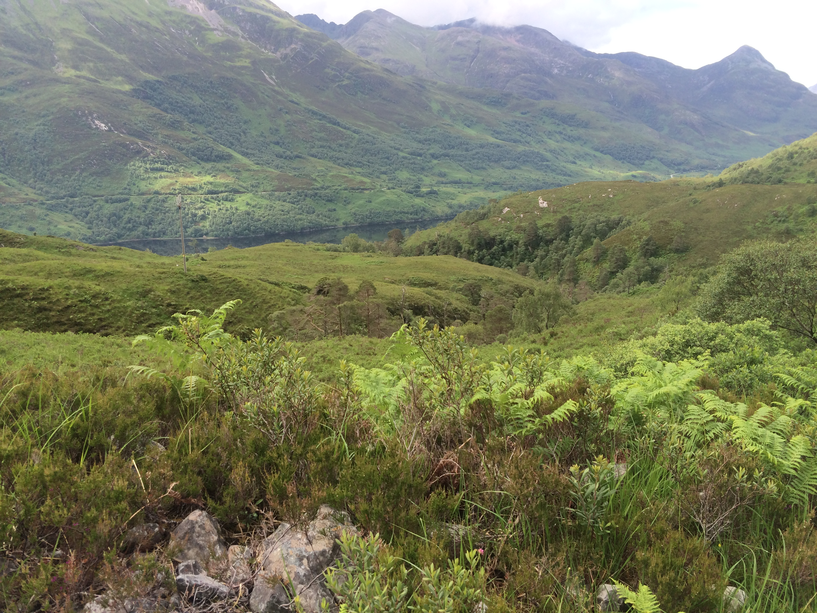
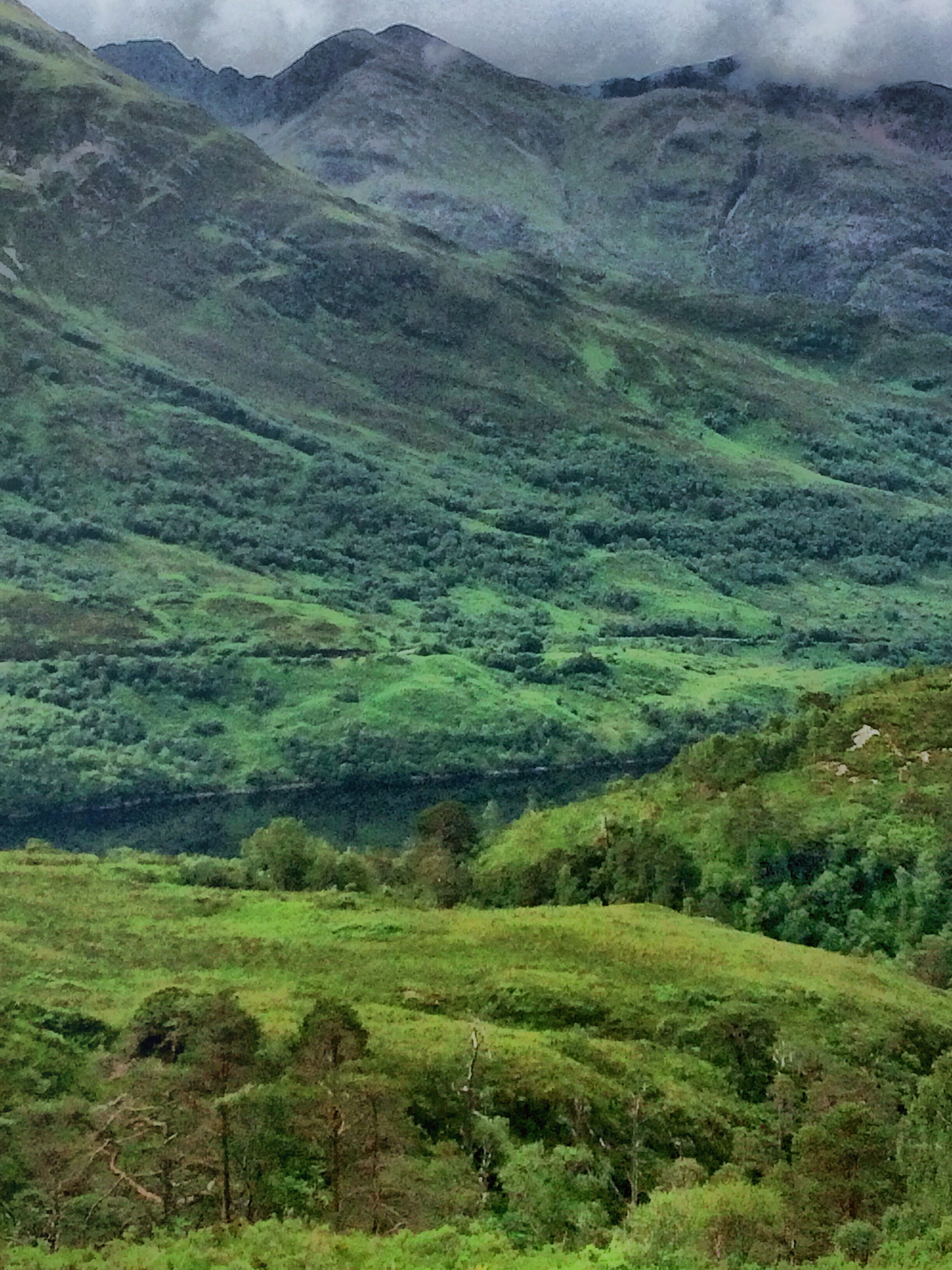
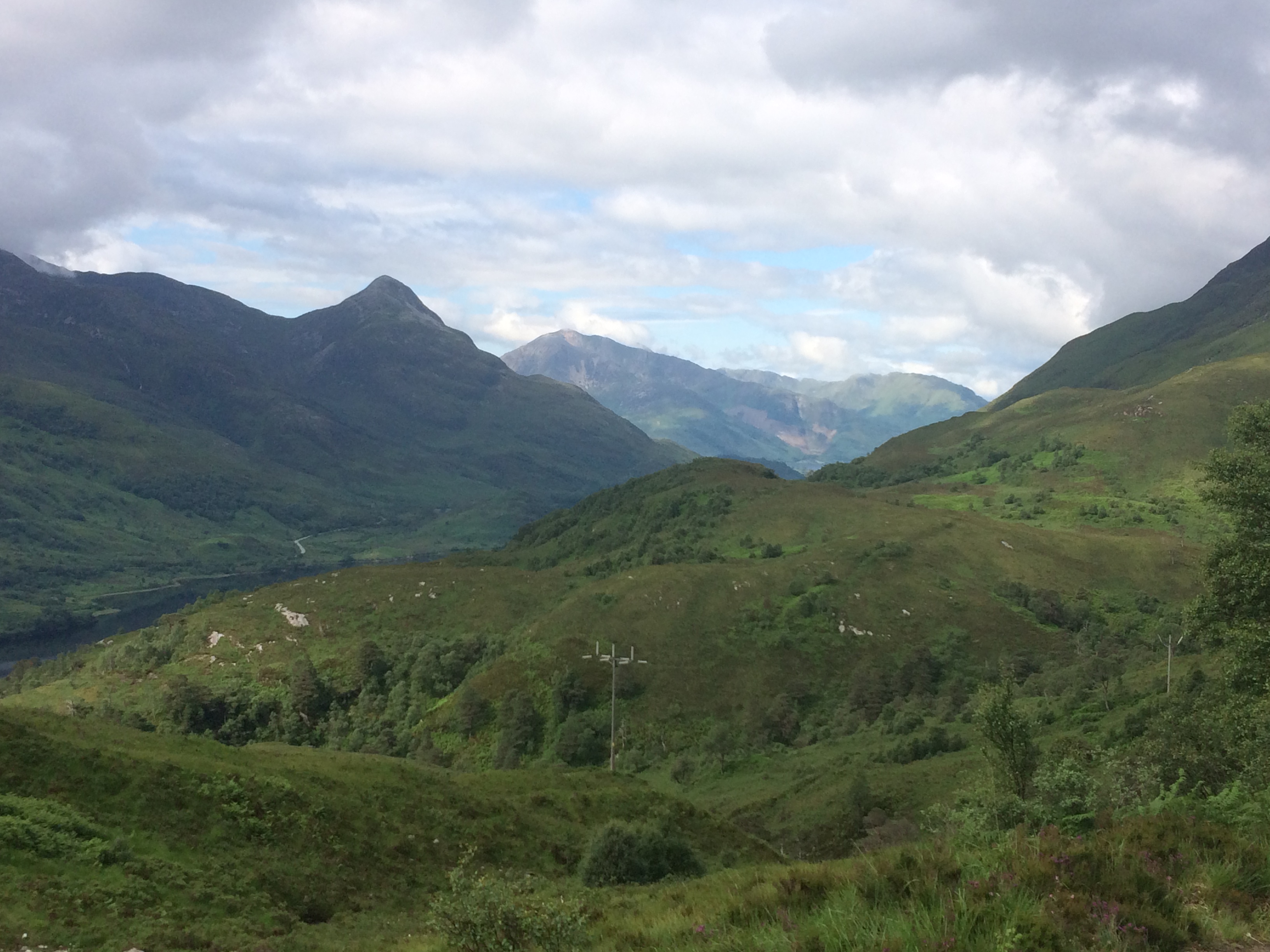
And so to Rannoch Moor, a wild expanse of over 50 square miles both revered and feared for its savage terrain, and one of my inspirations for coming to Scotland. It was a fabulous day of vigorous wide-open skies and dancing clouds occasionally exposing patches of blue or a shafts of sunlight, and sudden, short, showers of warm rain. There is a fabulous palette of colours knitted into the landscape: Purple Heathers, red peaty earth, the white fluffy tops of windswept cotton grass. The moor is pocked with silvery pools of water and an intricate web of streams. Distant mountains veiled in blue mist roll out creating a sense of endless depth to the landscape – it is beautifully wild. Robert McFarland writes in The Wild Places: ‘Open spaces bring something to mind which is difficult to express, but unmistakable to experience – and Rannoch is among the greatest of those spaces’.
I walked for a while with a couple of chaps from Hampshire, but I think they were in some kind of hurry to get to the other side and soon left me behind. The path – an old drovers’ road – is long, long, long but I was completely happy walking across it; I would go back to Scotland just to walk across Rannoch Moor. The end of this section is marked by the Kingshouse, one of the oldest inns in Scotland, dating back to the 17th century. There are two signs outside the hotel: ‘Climbers Bar’ and ‘Cocktail Bar’. As I wasn’t feeling too glamorous and besides, had failed to pack a cocktail dress, I went around the back to the entrance to the Climbers Bar. Before going in I stopped for a moment to watch a beautiful stag with huge antlers loiter on the edge of the moor. The Climbers Bar provides everything you would want after a 20 miles walk across Rannoch Moor (i.e. wine, food). It was here that I met Kevin, a teacher from LA and he was great company. We talked about hiking, music, career, LA v. London, Trump v. Brexit, gun laws v. “I haven’t got a clue what our gun laws are”.
I camped in the grounds of the Kingshouse which they are happy for you to do, there are no facilities though.
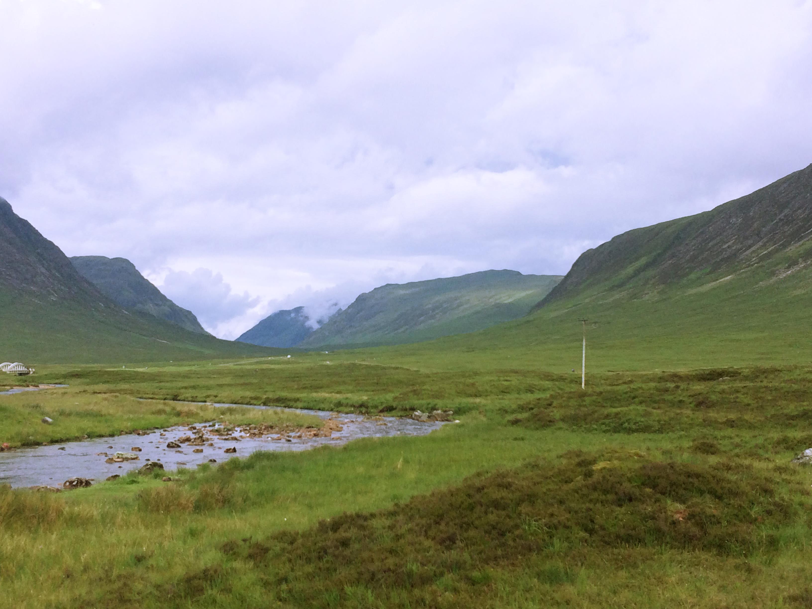
Day 6: Kingshouse to Kinlochleven – 8.75 miles
Waking up next to the bubbling River Etive and the wondrous rocky mass of Stob Dearg looming above was a spectacular start to the day. I naively decided to warm up some beans and make some tea for breakfast – not a well thought out idea as I was immediately mobbed by a million midges and forced back into my tent feeling, quite frankly, a little embarrassed.
As this was a short day, I arrived at Kinlochleven mid-afternoon and pitched my tent at Blackwater Camping. It was here that I also managed to finally recharged my phone and get some reception, only to hear the news of Brexit and Cameron’s resignation. Some campsite ranting took place among my fellow hikers (the young Belgian couple found it highly amusing).
On a happier note, the River Leven by which Blackwater Camping is situated, is a beautiful, lush, happy river. I sat on the riverbank and listened to the water flowing over the rocks, it had stopped raining and the sun was filtering through the trees. One of the Fast-Walking-Men-of-Hampshire joined me by the river – but after espousing how much he loved nature and camping and Scotland and blah blah blah, he then proceeded to smoke two cigarettes throwing the butts into the river. Twat.
I had dinner with my new friend Kevin and some other fellow hikers at the Highland Getaway which was pretty good.
Day 7: Kinlochleven to Fort William – 14 miles
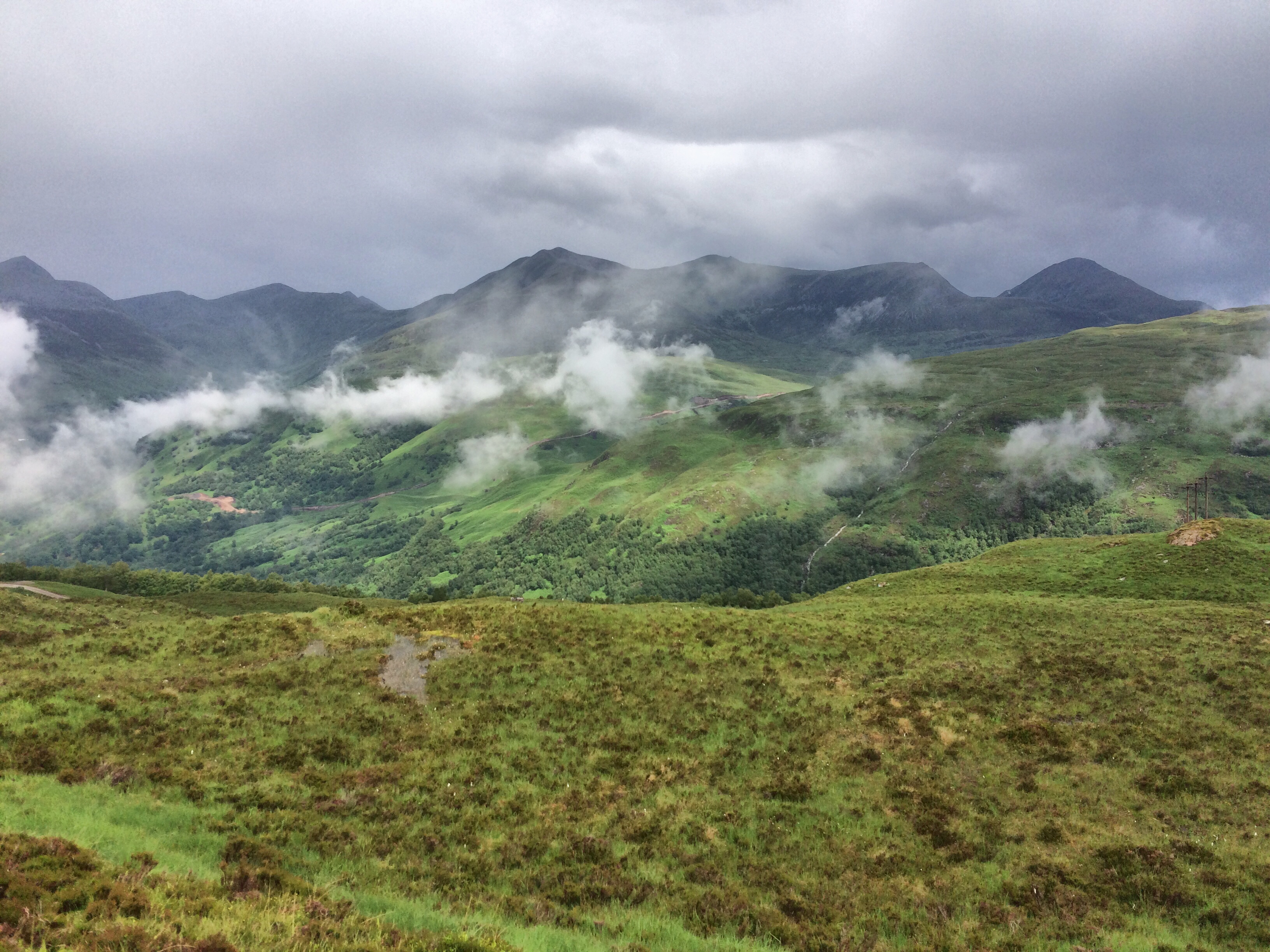
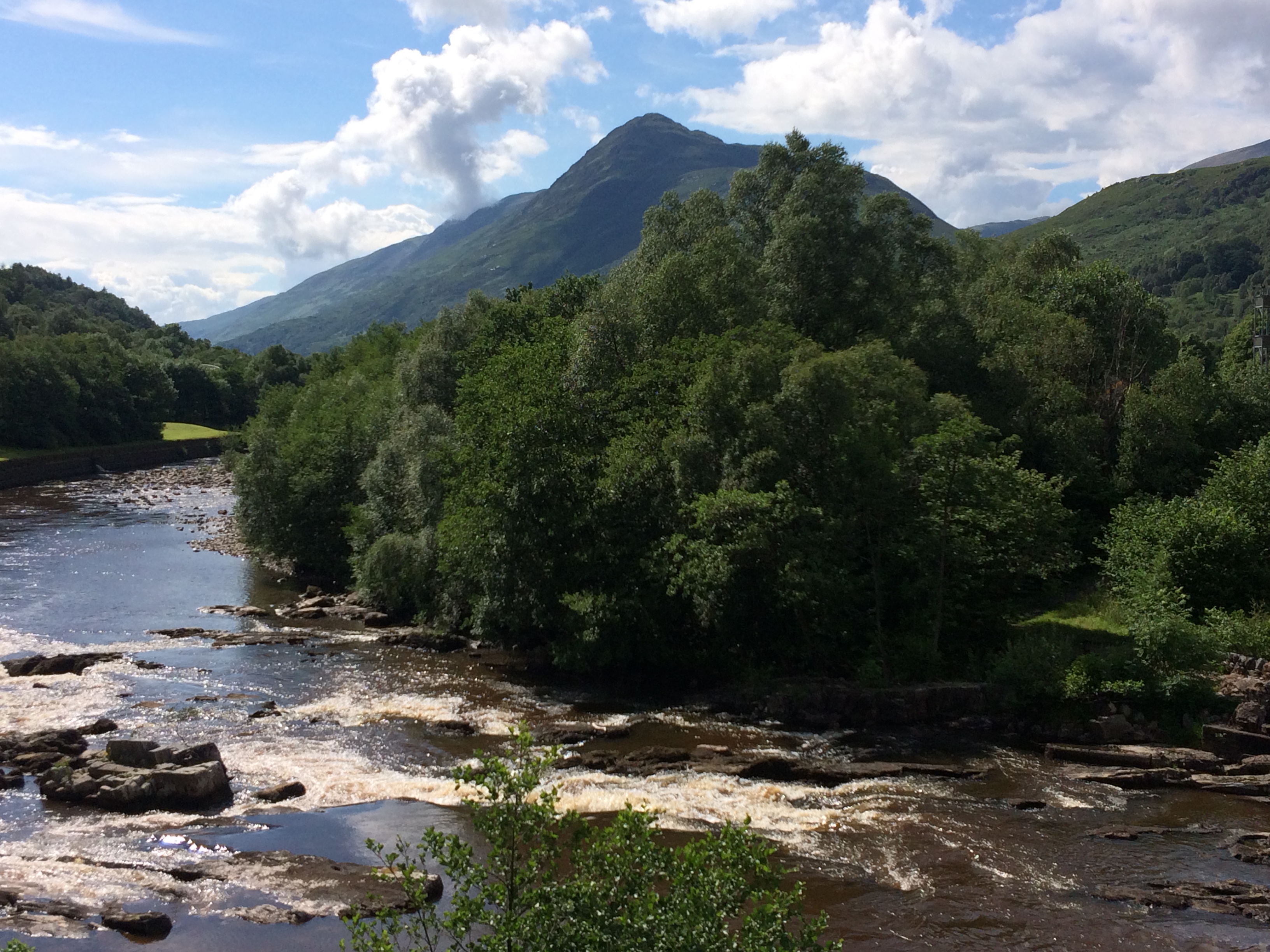
By the last day of the West Highland Way, I was in an almost dreamlike state of happiness. The changing terrain seemed to match my moods which culminated in a spectacular final day. From the uphill climb out of Kinlochleven, the trail emerges from the woods to a fabulous view over Loch Leven. I wasn’t expecting the terrain to be so beautifully lush and green and abundant but considering the amount of rain fall, perhaps it’s not really that surprising. Being surrounded by the enchanting silence of mountains – views that seem to find a way inside you – was a perfect way to end the trip.
Later in the day I bumped into fellow hiker Anneke, and we did the final descent into Fort William together. The official end is at the end of town’s main drag where the ‘Weary Walker’ sits (not the ‘false’ end outside the souvenir shop), We celebrated by standing in the rain eating ice-cream. Later we met with Kevin and drank beer and shared our joy of reaching the end of the West Highland Way; it was a wonderful moment of happiness. As Anneke and I both had a remaining day left in Scotland before returning to London, we agreed to walk up Ben Nevis and plant an EU flag.
And that was it. I had walked 94 miles through Scotland and felt amazingly happy!

Day 8: Ben Nevis
Day 9: Fort William to Glasgow by train; Glasgow to south-east London via City Airport.
Fort William to Glasgow by train: My advice is to book your seat in advance to ensure you can sit by the window, and then just relax and enjoy this fabulous train journey through the Highlands.
… and to the airport, a short flight back to London and the DLR home.
The End! (thanks Mum, for reading the whole post)